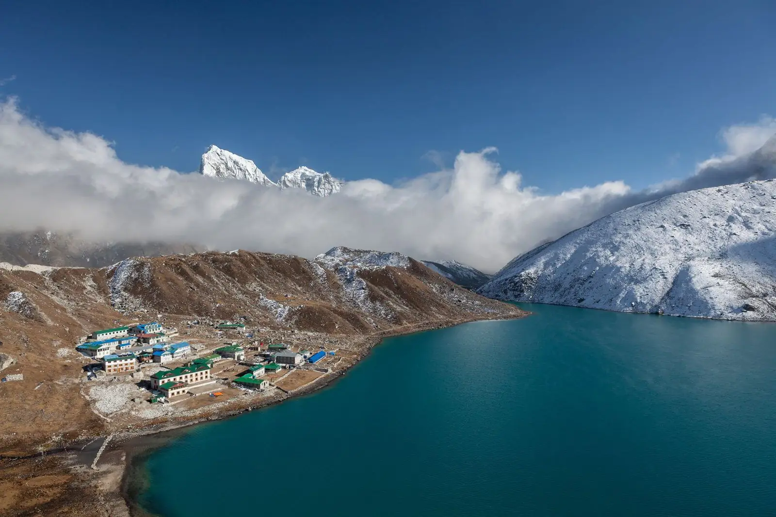
The simple Gokyo Lakes trek goes up the Dudh Kosi valley to Gokyo and returns the same way in 11 to 13 days. Adding the Renjo La, at about 5,360 m, turns it into a loop that comes down through the quiet Thame valley and takes about the same time or a day longer. The pass adds one hard day and one of the best views of Everest in Nepal.
Gokyo out and back and Gokyo with Renjo La at a glance
- Days from Kathmandu. Gokyo out and back: 11 to 13. Gokyo with Renjo La: 12 to 14.
- Highest point. Gokyo out and back: Gokyo Ri, 5,357 m. Gokyo with Renjo La: Renjo La, about 5,360 m, plus Gokyo Ri.
- Return route. Gokyo out and back: back down the Gokyo valley. Gokyo with Renjo La: over the pass to Lungden, Thame and Namche.
- Hardest day. Gokyo out and back: the climb of Gokyo Ri. Gokyo with Renjo La: the pass: 7 to 9 hours with a steep climb and long descent.
- Technical ground. Gokyo out and back: none. Gokyo with Renjo La: none in normal conditions; stone steps and scree.
- Crowds. Gokyo out and back: moderate. Gokyo with Renjo La: very quiet beyond the pass.
What the Renjo La adds
The Renjo La is the gentlest of the three high passes of Khumbu. From Gokyo the trail skirts the third lake and climbs steadily to a notch hung with prayer flags. The view back is the reason people come: Everest, Lhotse and Makalu stand above the Ngozumpa Glacier with Gokyo and its lake directly below. Many trekkers think it better than the view from Gokyo Ri, because the lake is in the foreground. The descent on the far side uses stone steps to a small lake and then a long valley to Lungden.
The Thame valley
Beyond the pass you walk out through the Bhote Kosi valley, the old trade route to Tibet over the Nangpa La. Villages here, Lungden, Marulung and Thame, see far fewer trekkers than the main Everest trail. Thame has an old monastery on the hillside above the village and is the home village of several famous Sherpa climbers. It is a peaceful end to the trek before the bustle of Namche.
Difficulty and safety
The pass day is long and starts before dawn. There is no glacier crossing, which makes it simpler than the Cho La, but after snowfall the upper section can be icy and the trail hard to follow. There are no lodges between Gokyo and Lungden, so you carry lunch and water. Go with a guide, check conditions the evening before, and do not attempt it if you have any sign of altitude sickness: the only way off is over or back.
Best season and what to carry
October, November, April and May give the best odds of a clear, dry pass. In December to February the lakes freeze and the Renjo La is often snowbound, so the out-and-back trek is the realistic winter plan. For the pass carry microspikes, a head torch, warm gloves, at least two litres of water and food for the day. Trekking poles save the knees on the long descent to Lungden.
Altitude on the Gokyo side
The Gokyo valley gains height quickly. From Namche at 3,440 m the trail reaches Machhermo at about 4,470 m in two days if you rush, which is too fast for many people. A sound plan sleeps at Dole or Phortse Thanga, then Machhermo, then Gokyo, with an extra night somewhere on the way. Trekkers who reach Gokyo already feeling poorly should rest or go down, not head for the pass.
Choose Gokyo out and back if
- You want the lakes and Gokyo Ri with the least risk.
- You are trekking in mid-winter or just after heavy snow.
- Someone in the group is slow to acclimatise.
- You prefer shorter days.
Choose Gokyo with Renjo La if
- You dislike returning by the same trail.
- You are fit and have had no altitude problems by Gokyo.
- You want the famous view of Everest over the lake.
- You like quiet valleys and Sherpa villages off the main route.
Can you do both?
You do not lose anything by adding the pass: you still visit the lakes and climb Gokyo Ri first. Decide in Gokyo. If the weather or your health is doubtful, simply walk back down the valley.
Plan it
See the Gokyo Lakes guides and the three passes compared, or ask us for an itinerary.
Common questions
How hard is the Renjo La?
It is a long, steep day at high altitude with no technical climbing in normal conditions. Fit trekkers who are well acclimatised manage it.
Is the Renjo La easier than the Cho La?
Generally yes. It has no glacier and a better trail, though it is a similar height.
Which direction is better?
From Gokyo west to Thame is the usual way, because you are already acclimatised and the view is behind and around you at the top.
Do I need a guide?
Yes. A licensed guide is expected in the region, and on a pass day route-finding and judgement matter.
Heights, days, fees and rules are approximate and can change, so confirm the current details with us before you book.