Cho La is a high pass at about 5,420 m in the Everest Region. It connects the Gokyo valley with Dzongla and Lobuche, which makes it the usual link between the Gokyo Lakes and Everest Base Camp, and one of the three crossings on the Three Passes trek.
The name is also spelled Chola Pass or Chola La on some maps and signboards.
Altitude: about 5,420 m. Heights quoted for villages and camps vary by source, so treat this as a guide.
Where Cho La is and why trekkers cross it
Cho La crosses the ridge between the Gokyo valley and the Khumbu side near Dzongla. Trekkers cross it to combine Gokyo and Everest Base Camp into one loop of roughly two and a half weeks rather than walking out and back along each valley. Most go from Thaknak on the Gokyo side up to the pass and down to Dzongla. It also forms part of the Three Passes route with Renjo La and Kongma La.
What the crossing is like
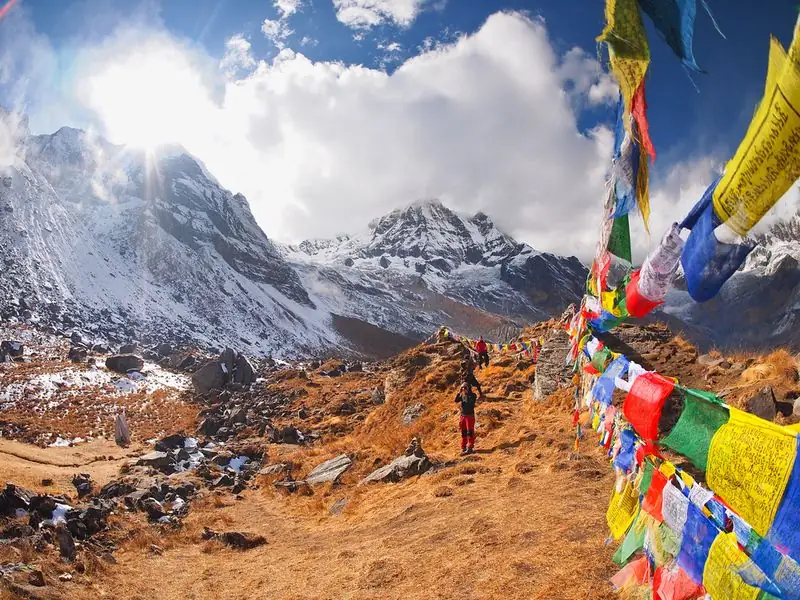
The approach from the Gokyo side crosses a stretch of glacier with crevasses that are usually visible, then climbs steeply over rock and ice to the top. Prayer flags mark the pass, and the views of Cholatse and the surrounding peaks reward the effort. The descent to Dzongla is a steep, loose rocky slope, so take it slowly. The day is long, and timing varies with pace, fitness and trail conditions, so leave early and allow daylight to spare.
Altitude and how you may feel
At about 5,420 m you are well above the sleeping altitude of both Thaknak and Dzongla, and the air is thin. Expect heavy breathing, a slower pace and possibly a headache. Altitude illness can strike at any fitness level. If symptoms worsen, with confusion, severe headache, vomiting or unsteadiness, descend rather than continue. Deteriorating weather or heavy snow is also a reason to turn back, since conditions on the glacier side can change quickly.
Gear, food and practical tips
Carry layers, gloves, a hat, sun protection and sturdy boots. Microspikes or crampons are recommended for Cho La, especially early or late in the season, and poles help on the loose descent. Bring lunch and water, as there is nothing to buy on the pass. Going with an experienced guide is wise, since the glacier section can change from season to season. Keep a spare day in your schedule for weather. Keep a spare pair of dry socks within reach, because cold feet make for a poor night.
Common questions
How high is Cho La?
Cho La is about 5,420 m. That is lower than Kongma La at about 5,535 m but higher than Renjo La at about 5,360 m, and well above the villages on either side.
Is Cho La dangerous?
It is a serious high pass with a glacier approach and a steep, loose descent. The risk is manageable with good acclimatisation, early starts, suitable traction and an experienced guide, and by turning back in poor weather.
How do I cross from Gokyo to Everest Base Camp?
Most trekkers go from Thaknak over Cho La to Dzongla, then on to Lobuche and base camp. The whole Gokyo and Everest Base Camp loop usually takes about 16 to 18 days.