The Nar Phu Valley is a pair of side valleys that fall away to the north of the Marsyangdi river, close to the Tibetan border, in the Manang district of the Annapurna Conservation Area. Two villages, Phu and Nar, sit at about 4,000 m and are reached by a trail that spends its first day inside a narrow, shadowed gorge. Most people walk it as a detour from the Annapurna Circuit: they leave the main trail at Koto, spend a week in the valleys, cross the Kang La pass at around 5,300 m, and rejoin the Circuit near Ngawal and Manang.
Where it sits on the map
If you picture the Annapurna Circuit as a loop around the Annapurna massif, the Nar Phu Valley is a spur that points north at the loop's top-left corner. The turn-off is at Koto, a small settlement just past Chame at about 2,600 m, where the Circuit continues to Pisang and the Nar Phu trail follows the Phu Khola upstream. The two valleys, Phu and Nar, join near Nar Phedi and then split again: one arm climbs to Phu village, the other to Nar village. Between them and the main Circuit lies the Kang La, the only practical way back without retracing your steps.
The region was closed to foreigners for a long time because of its position beside Tibet, and was opened to trekkers only in the early 2000s. It still operates as a restricted area: you need a special permit, a registered agency and a licensed guide. Our page on Nar Phu restricted-area fees and rules explains the money side; our step-by-step permit guide explains the paperwork.
What the trek is actually like
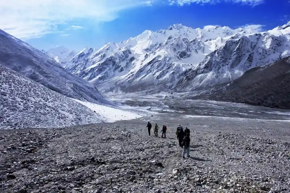
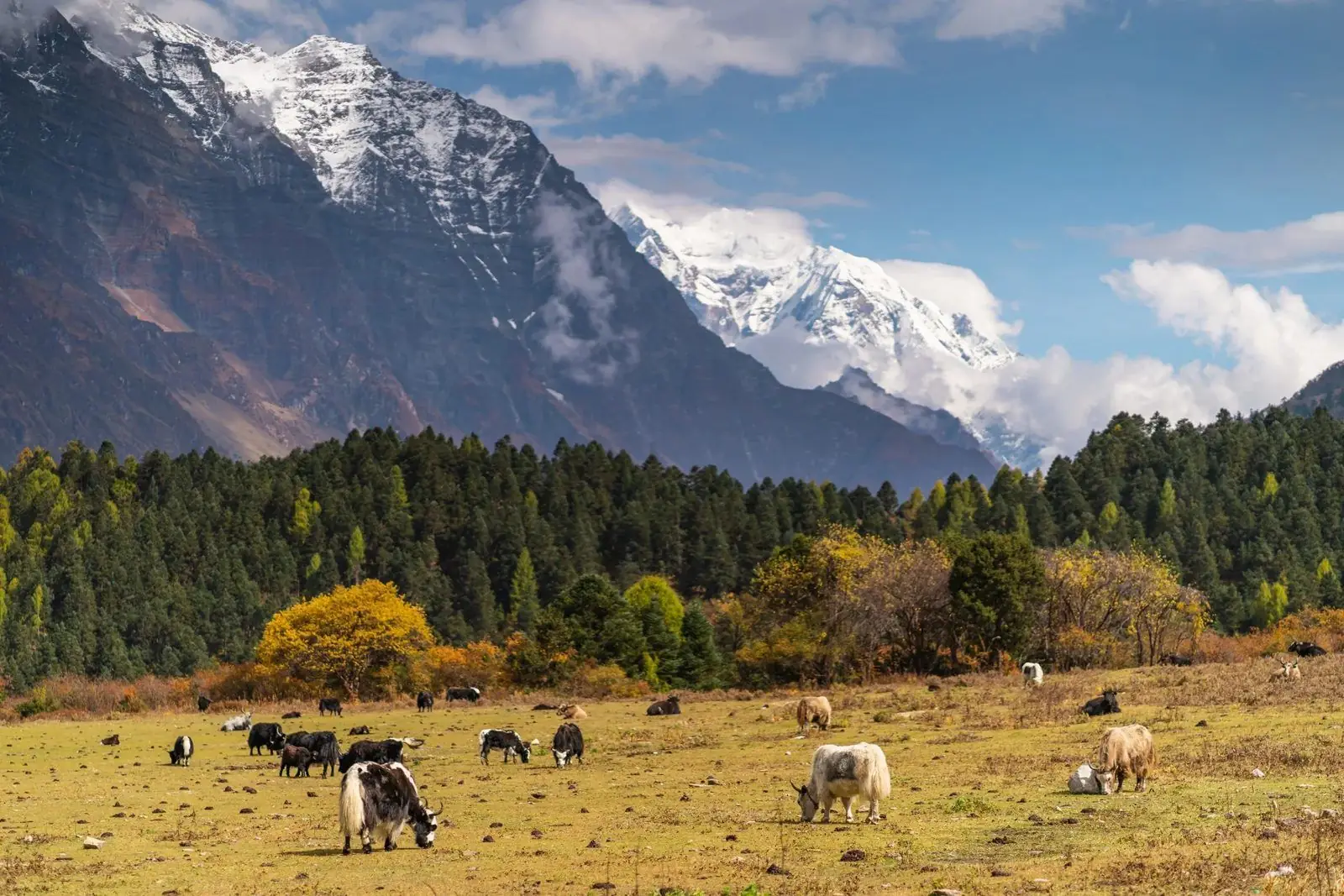
The trail is a story in three acts. The first act is the gorge: from Koto the path squeezes between steep rock walls, crosses the river on suspension bridges, and climbs through pine and juniper forest in light that rarely reaches the valley floor. The second act is the high valley country around Kayang and Phu, where the landscape opens into a broad, dry, Tibetan-style plateau of stone-walled fields, chorten and mani walls. The third act is the pass: a long climb out of Nar over loose scree to the Kang La, then a long, knee-testing descent towards Ngawal and the Manang valley.
Compared with the standard Circuit, the Nar Phu Valley has no road, almost no vehicle noise, fewer lodges, simpler food and many more hours on the trail with no village in sight. In the main spring and autumn weeks the Circuit can feel busy; here you will probably share the valley with only a handful of other groups.
How long it takes
From Koto, a comfortable Nar Phu loop that ends in Ngawal or Manang normally takes 8 to 10 walking days, including one acclimatisation day at Phu or Nar and a buffer for weather at the pass. Added to a full Annapurna Circuit, the whole trek is typically 18 to 22 days from Kathmandu. If you are short of time, a few itineraries use a jeep from Besisahar to Koto; that saves two to three days of road walking but takes away early acclimatisation, so the days you gain should go back into the Nar Phu schedule, not into a faster pass crossing.
Our day-by-day Nar Phu itinerary shows a realistic pace.
How hard is it?
Nar Phu is harder than the main Circuit, and the reasons are specific. The days are longer, because distances between villages are bigger. The lodges are simpler, so rest is poorer. The altitude gain from the gorge to Phu and Nar is steady rather than gentle, and then the Kang La, at roughly 5,300 m, is a pass of the same order as Thorong La but with more remote approach, rougher footing and no jeep or helicopter shortcut if you change your mind halfway up. None of this is technical; a fit walker with trekking poles can do it. It does demand stamina, acclimatisation discipline and a guide who can read the weather.
What you will see
- Narrow gorge walking with waterfalls and large rock overhangs in the first two days.
- Stone-built villages at 3,500 to 4,200 m with flat roofs piled with yak-dung fuel and firewood.
- Old Buddhist gompas, including Tashi Lakhang near Phu, set against bare cliffs.
- Prayer-flag ridges, long mani walls and chorten that frame the trail at every village entrance.
- Free-ranging yak and goat herds, and, with luck, blue sheep on the slopes.
- Views of Himlung Himal and other peaks of over 6,500 m above Nar, and of the Annapurna II and IV ranges once you cross the pass.
Who should choose it
- Trekkers who have already done one high trek (Annapurna Base Camp, Everest Base Camp or the standard Circuit) and want something quieter.
- People who care more about culture, landscape and solitude than about hotel comfort.
- Walkers who are comfortable with a pass above 5,000 m and are willing to add buffer days.
- Anyone who wants to combine the Nar Phu Valley with the Annapurna Circuit and Tilicho Lake in a single long journey.
Who should think twice
- First-time trekkers with no previous experience above 3,500 m.
- Anyone who needs a fixed return date inside two weeks, because the pass crossing needs flexibility.
- People who need reliable phone signal, charging or hot showers every day.
- Trekkers with a history of serious altitude illness, unless their doctor has cleared them in writing and the itinerary is built around slower ascent.
Where to go next
If you are comparing Nar Phu with other restricted or semi-restricted valleys, read Nar Phu vs Tsum Valley vs Upper Mustang. If you are building a longer Annapurna journey, our Annapurna Circuit guides and Tilicho Lake guides go deeper into the connecting sections.
Common questions
Is the Nar Phu Valley trek open to everyone?
It is open to foreign and Indian nationals who travel through a registered agency with a licensed guide and a restricted-area permit. You cannot walk it independently.
How many days do I need for Nar Phu?
Plan for 8 to 10 walking days from Koto to Manang, or 18 to 22 days for Nar Phu combined with the full Annapurna Circuit from Kathmandu.
Is Nar Phu harder than the Annapurna Circuit?
Yes, because of longer days, simpler lodges and the Kang La pass at about 5,300 m. It is not technical, but it is more demanding than the standard Circuit route.