 By
A Muktinath trek ends at one of Nepal’s holiest temples, at about 3,749 m according to the Nepal Tourism Board, and you can reach it on foot in three very different ways. The famous route crosses Thorong La, a pass at 5,416 m, on the Annapurna Circuit. The gentler routes start from Jomsom and take a day or two. Which one suits you depends on your time, fitness and how much altitude you want to take on.
This guide compares the routes, explains the Thorong La crossing, shows what the official pages say about permits, fees and season, and tells you what to plan before you go. It is written for first-time trekkers as well as pilgrims who want to walk the last stretch.
Muktinath trek at a glance
- Altitude of Muktinath: 3,749 m on one Nepal Tourism Board page and 3,800 m on another, so plan for about 3,700 to 3,800 m.
- Highest point on the classic route: Thorong La, 5,416 m.
- Short option: fly Pokhara to Jomsom, then walk to Muktinath. The board gives about five hours on foot.
- Classic option: the Annapurna Circuit, which the board says takes a minimum of about three weeks for the full loop.
- Best months: March to May and September to November (Nepal Tourism Board).
- Permits: a Park Entry Permit and a TIMS card from the Tourist Service Centre in Kathmandu.
Last checked: 4 November 2026. Route, altitude, permit and season facts come from Nepal Tourism Board and Gandaki Province tourism pages. Roads, flights and trail conditions change, so we confirm everything at booking. Planning advice is our own.
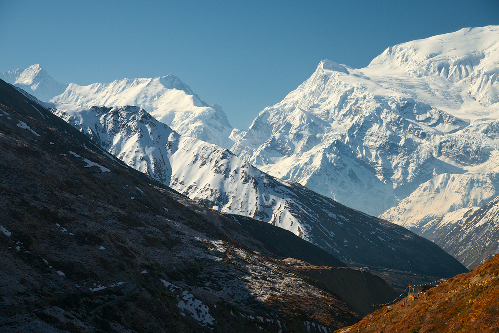
The trail towards Thorong La, the high point of the classic Muktinath trek.
In this guide: Three ways to trek to Muktinath | Thorong La | Roads on the route | Season | Permits | At the temple | Altitude | FAQ
Three ways to trek to Muktinath
| Route | What the official pages say | Our notes |
|---|---|---|
| Short: Jomsom to Muktinath | The board says regular flights connect Pokhara and Jomsom, and it is a five-hour walk from Jomsom to Muktinath. | Best for a first Himalayan trek, older walkers and short holidays. You can drive back. |
| Classic: Annapurna Circuit over Thorong La | The trek goes counter-clockwise from Besisahar, follows the Marsyangdi river to Manang and reaches its high point at Thorong La (5,416 m). The board says the full circuit takes a minimum of about three weeks. | The big adventure. Needs fitness, acclimatisation days and good weather. |
| Circuit with a side trip to Tilicho Lake | The board lists Tilicho Lake among the added attractions of the Annapurna Conservation Area. | For trekkers with extra days who want a second high lake and more acclimatisation. |
The third column is our guidance, not an official statement. We run the classic route as an organised trek: see our Annapurna Circuit 18-day trek and the version with Tilicho Lake.
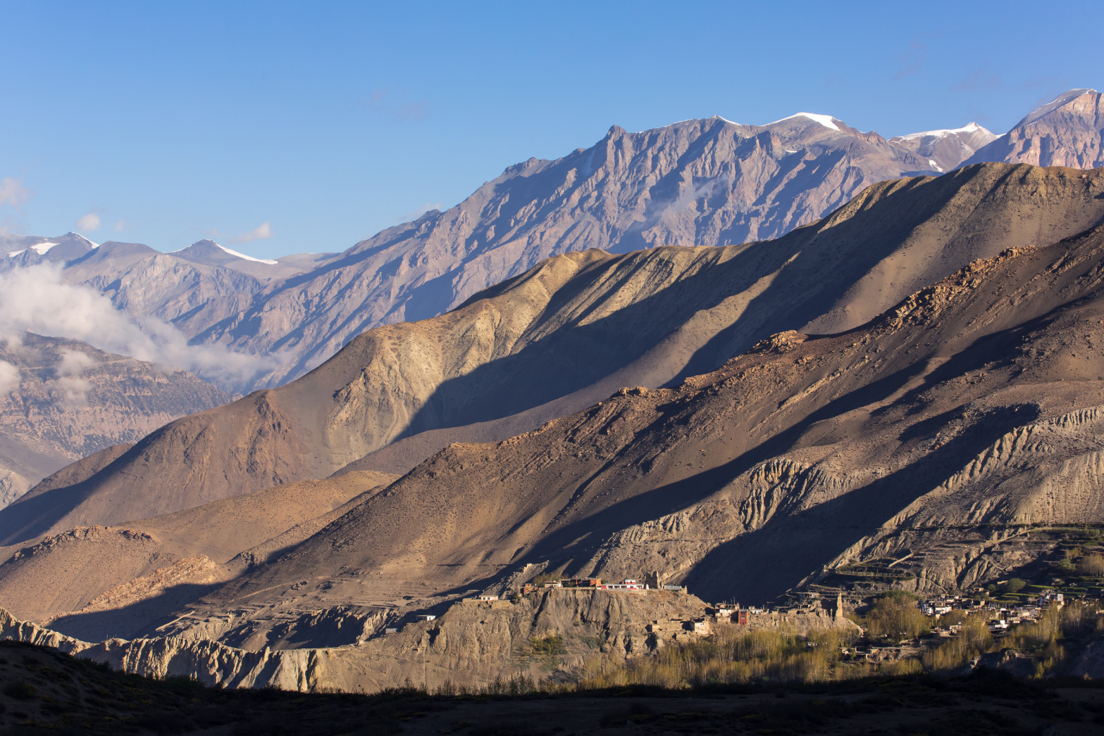
Beautiful mountain landscape of Muktinath village in lower Mustang
Route 1: the short Jomsom to Muktinath walk
The Nepal Tourism Board notes that there is an airport at Jomsom for access to Mustang, with regular flights from Pokhara. From Jomsom it describes a five-hour walk to Muktinath. Gandaki Province tourism puts Muktinath about 23 km north of Jomsom. That makes this the easiest way to say you trekked to Muktinath.
We usually suggest an overnight near Jomsom first, then the walk the next day, with the option to drive back. Flights depend on weather, so keep a spare day. That last point is our experience.
Route 2: the Annapurna Circuit finish
The classic Muktinath trek is the second half of the Annapurna Circuit. The board describes the trek going counter-clockwise from Besisahar, following the Marsyangdi river upstream to Manang, “a string of seven villages,” then climbing to Thorong La. Beyond the pass the trail drops to Muktinath. Our guide to the road and jeep sections explains which stretches you can skip.
Crossing Thorong La
Thorong La is the high point of the circuit at 5,416 m, according to the Nepal Tourism Board. It is higher than Everest Base Camp, and it is the part of the Muktinath trek that needs respect.
| Stage | Official facts | What it means |
|---|---|---|
| Annapurna Conservation Area start | The area begins at 790 m and rises to 8,091 m (Nepal Tourism Board). | A huge altitude range, so the first days feel nothing like the last. |
| Manang | A string of seven villages along the Marsyangdi (Nepal Tourism Board). | A good place for acclimatisation days before the pass. |
| Thorong La | 5,416 m, the high point of the route (Nepal Tourism Board). | Cross early in the day and only in good weather. |
| Muktinath | 3,749 m and 3,800 m on two board pages. | You descend about 1,600 m after the pass, which is a relief. |
The third column is our advice. The board gives no day-by-day stages or acclimatisation schedule, so we plan those ourselves: rest days in Manang, a slow approach to the base of the pass, an early start on pass day and a weather buffer. See altitude sickness: symptoms and what to do.
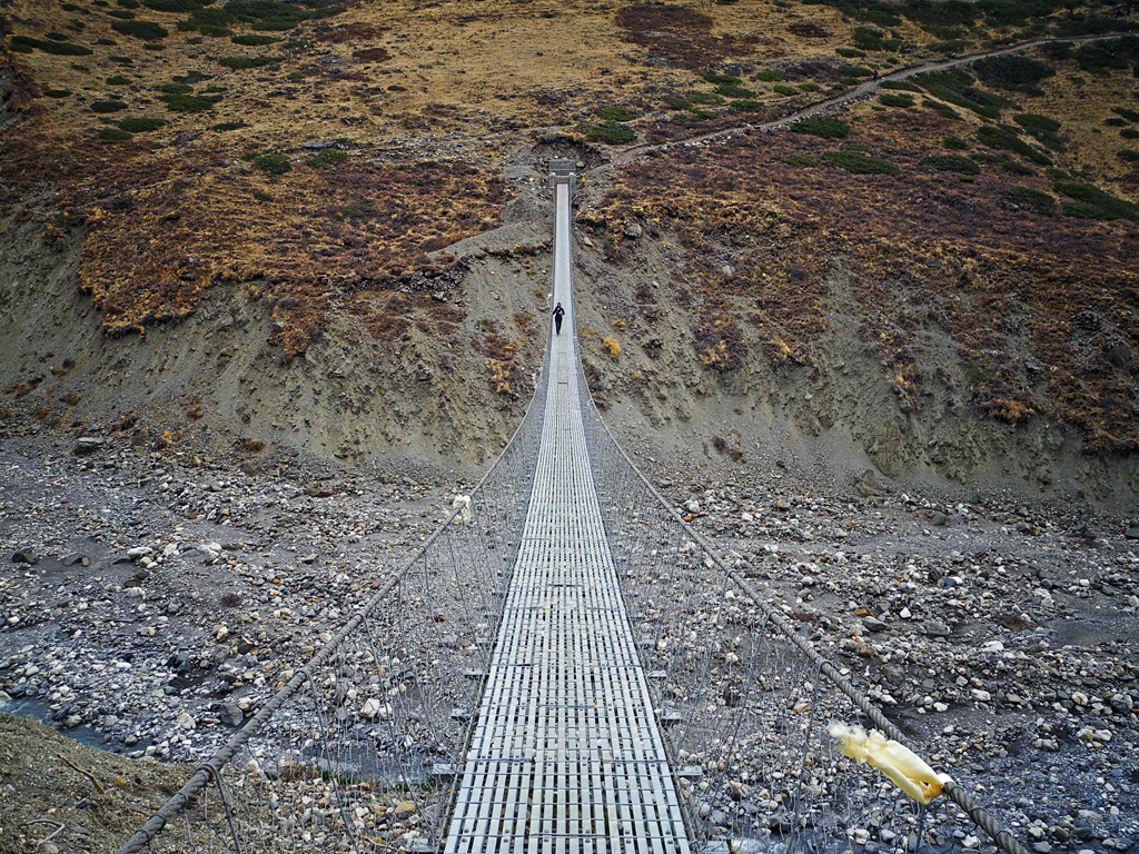
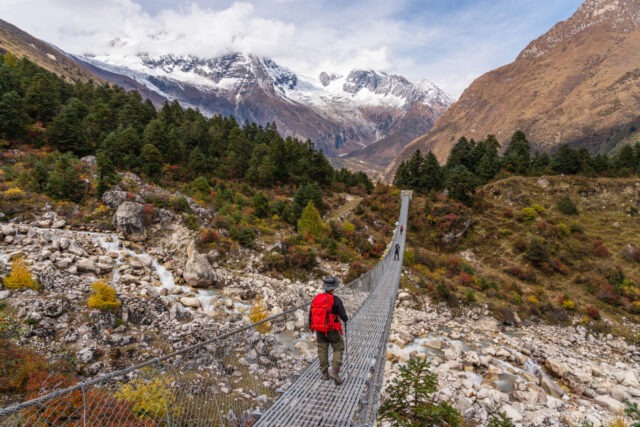
A suspension bridge on the trail before Thorong La.
Roads on the route
The trek is not as remote as it once was. The board says there is now a motorable road from Muktinath to Beni, where you can catch a bus to Pokhara. Gandaki tourism lists Pokhara to Jomsom as 158 km by bus or jeep, or by plane. Roads have changed how many trekkers do the circuit: some skip the early days by jeep and start higher.
That is a real choice, not a shortcut to feel bad about. Jeeping the early stretch saves time but can mean arriving at altitude faster, so build in extra acclimatisation if you do it. Our road and jeep sections guide goes into the details.
Best season for the Muktinath trek
| Time | What it is like | Our advice |
|---|---|---|
| March to May | Listed by the Nepal Tourism Board as a best season for the Annapurna Conservation Area. | Good weather, rhododendron colour lower down, and a safer window for Thorong La. |
| June to August | The monsoon. The board says Upper Mustang, which is in the rain shadow, can be visited then. | Rain and landslides affect the lower circuit. Muktinath itself is easier than the full loop. |
| September to November | Also a best season in the board listing. | Clear skies and the busiest trekking months. |
| December to February | Cold, with snow possible high up. | Thorong La can close. Only for well-prepared trekkers. |
The monsoon sentence about the rain shadow is the board’s statement about Upper Mustang, which lies north of Muktinath. The snow and closure notes are our general assessment, not official figures.
Permits and fees
The Nepal Tourism Board says the Park Entry Permit and the TIMS card must be obtained from the Tourist Service Centre at Bhrikutimandap in Kathmandu. Its Annapurna Conservation Area page lists these per-entry fees:
| Visitor | Fee on the board’s ACAP page |
|---|---|
| Nepali citizens | Free |
| SAARC nationals (including Indian citizens) | NPR 200 per person per entry |
| Other foreigners | NPR 2,000 per person per entry |
Check the figures before you travel: another Nepal Tourism Board page has listed NPR 3,000 for foreigners. The board also says an Upper Mustang trek needs a separate trekking permit from the Department of Immigration. That applies to Upper Mustang, not to the Muktinath trek. We confirm the current fee and the documents each traveller needs when we book. See our Annapurna permits guide.
Arriving at Muktinath
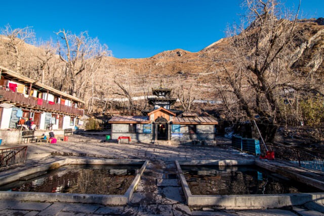
The temple is sacred to both Hindus and Buddhists. The Nepal Tourism Board says Hindus worship Lord Vishnu here, while Buddhists worship him as Avalokiteshwar. It describes 108 sacred waterspouts where pilgrims take a ritual bath, and an eternal flame that keeps burning in the temple area. Gandaki tourism adds that Buddhists call it “Chhumi Ghyalche” in Tibetan.

Muktinath temple, the end of the trek. Photo from the Base Camp Hikes archive.
The board gives no dress or photography rules, so ask your guide on the day. Mornings are usually quieter. For more on the temple and its significance, see our Muktinath temple article and the Muktinath pilgrim route guide.
Altitude and preparation
- Go slowly. Take rest days at Manang and do not rush to the pass.
- Know the warning signs. Headache, nausea and breathlessness need an early word with your guide.
- Train for it. Weeks of hill walking and stair climbing with a loaded pack help far more than gym work alone.
- Pack for cold. Nights above Manang are cold, and pass day starts well before dawn.
- Insure properly. Make sure your policy covers trekking at altitude and helicopter evacuation.
Muktinath trek or yatra by vehicle?
| Muktinath trek | Muktinath by flight and road | |
|---|---|---|
| How you arrive | On foot, short or over Thorong La | Flight to Jomsom and a vehicle |
| Time | A day or two, or about three weeks for the full circuit | A few days |
| Effort | Moderate to strenuous | Light, but the altitude still counts |
| Who it suits | Walkers who want the journey | Pilgrims, families and older travellers |
The time and effort rows are our general assessment. Both routes end at the same temple.
FAQ
What is the Muktinath trek? A walk to Muktinath temple in Mustang. You can do the short Jomsom to Muktinath walk, or the longer Annapurna Circuit over Thorong La.
How high is Muktinath? Nepal Tourism Board pages give 3,749 m and 3,800 m. Plan for about 3,700 to 3,800 m.
How high is Thorong La? 5,416 m, according to the Nepal Tourism Board.
How long does it take to walk from Jomsom to Muktinath? The Nepal Tourism Board gives about five hours on foot.
How many days is the Annapurna Circuit? The board says a minimum of about three weeks for the full circuit. Our organised trek is shorter because it uses road sections.
Is the Muktinath trek difficult? The Jomsom walk is moderate. Crossing Thorong La is strenuous because of the altitude and the long pass day.
When is the best time for the Muktinath trek? March to May and September to November, according to the Nepal Tourism Board.
Do I need a permit for the Muktinath trek? Yes. You need a Park Entry Permit and a TIMS card, both from the Tourist Service Centre at Bhrikutimandap in Kathmandu.
How much is the entry fee? The board lists NPR 200 for SAARC nationals, including Indian citizens, and NPR 2,000 for other foreigners. Another board page has listed NPR 3,000 for foreigners, so confirm before you go.
Can older people do the Muktinath trek? Many do the short Jomsom walk. Check with a doctor first, go slowly and travel with a guide. Thorong La is not for everyone.
Can I skip the road sections? Yes. A motorable road runs from Muktinath to Beni, and many trekkers use vehicles on parts of the route. We explain the options in our road and jeep sections guide.
How do I book a Muktinath trek with Base Camp Hikes? Message us with your dates, group size and fitness level. We confirm the route, permits and cost before you commit.
Plan your Muktinath trek with Base Camp Hikes
For dates and a quote, message the team on WhatsApp or phone at +91 932 595 1234 (9 am to 7 pm IST), write to info@basecamphikes.com, or use the enquiry form.
Sources
- Nepal Tourism Board: Annapurna Region (circuit route, Thorong La, Muktinath, airports, permits, road to Beni)
- Nepal Tourism Board: Annapurna Conservation Area (entry fees, best season)
- Nepal Tourism Board: Muktinath, Mustang (significance, spouts, flame, Jomsom walk)
- Gandaki Province tourism: Muktinath Temple (location, distance from Jomsom)