
 By
The Manaslu Circuit is a 14 to 18 day teahouse trek around Mount Manaslu (8,163 m), the eighth-highest mountain in the world. It crosses the 5,160 m Larkya La pass and passes through the Nubri region of northern Gorkha. Because it lies in a restricted area, daily visitor numbers are far lower than on the Everest and Annapurna routes, which makes it one of the most rewarding long treks in Nepal for experienced hikers.
This guide covers the route, permits, best seasons, difficulty, equipment and the questions we are asked most often.
Trek overview
| Detail | Information |
|---|---|
| Duration | 14 to 18 days in total, with 10 to 12 days of walking |
| Highest point | Larkya La Pass, 5,160 m |
| Difficulty | Strenuous |
| Best seasons | Mid-September to November; March to May |
| Route | Soti Khola or Machha Khola to Dharapani |
| Accommodation | Teahouses: simple twin rooms, shared bathrooms |
| Requirements | Restricted-area permit, licensed guide, minimum two trekkers |
Why choose the Manaslu Circuit
- Low trail traffic. Permit requirements limit numbers, so lodges and trails are quiet even in peak season.
- Diverse terrain. The route climbs from subtropical valleys at about 700 m to alpine terrain above 4,000 m.
- Cultural depth. Villages such as Lho, Samagaon and Samdo maintain Tibetan-influenced traditions, with gompas, mani walls and yak herding.
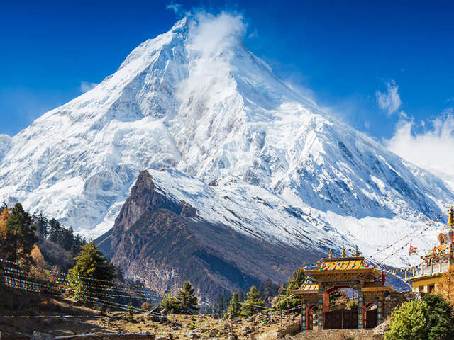
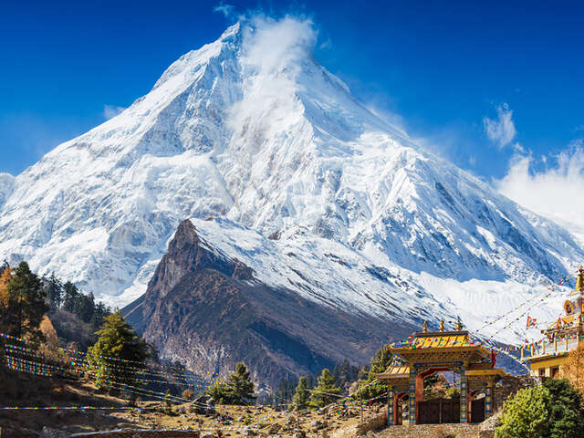
- Mountain scenery. Manaslu, Himalchuli, Ngadi Chuli and Peak 29 are visible from different parts of the trail, and the Annapurna range comes into view after the pass.
- A rewarding high pass. Larkya La is a demanding but non-technical crossing for well-prepared trekkers.
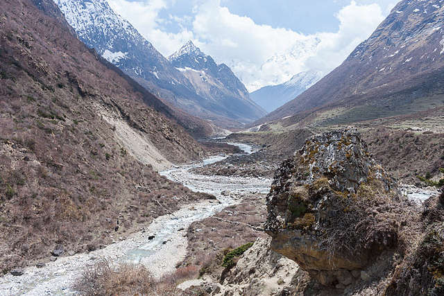
Trail views on the Manaslu Circuit
Route and itinerary
The trek follows the Budhi Gandaki river upstream, then crosses Larkya La and descends to the Marsyangdi valley. The standard schedule is below. We add buffer days for weather and a second acclimatisation day where the group needs one.
| Day | Route | Altitude |
|---|---|---|
| 1 | Drive Kathmandu to Soti Khola | 710 m |
| 2 | Soti Khola to Machha Khola | 930 m |
| 3 | Machha Khola to Jagat | 1,340 m |
| 4 | Jagat to Deng | 1,860 m |
| 5 | Deng to Namrung | 2,630 m |
| 6 | Namrung to Samagaon via Lho | 3,530 m |
| 7 | Acclimatisation day at Samagaon | 3,530 m |
| 8 | Samagaon to Samdo | 3,860 m |
| 9 | Samdo to Dharamsala (Larkya Phedi) | 4,460 m |
| 10 | Cross Larkya La to Bimthang | 5,160 m, descending to 3,590 m |
| 11 | Bimthang to Tilije | 2,300 m |
| 12 | Tilije to Dharapani | 1,860 m |
| 13 | Drive Dharapani to Kathmandu |
Lower valley (days 1 to 4). The trail follows the river through forest and terraced farmland, with several suspension bridges and steep stone stairways. These days are warm and physically demanding.
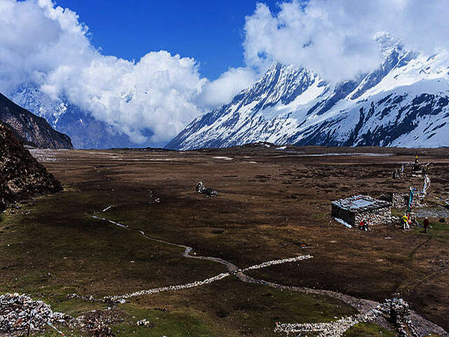
The circuit route through the Budhi Gandaki valley
Upper valley (days 5 to 8). Villages become Tibetan in style, with mani walls and gompas. Samagaon, at 3,530 m, is the main acclimatisation stop. Day walks to Birendra Tal or Pungyen Gompa are recommended.
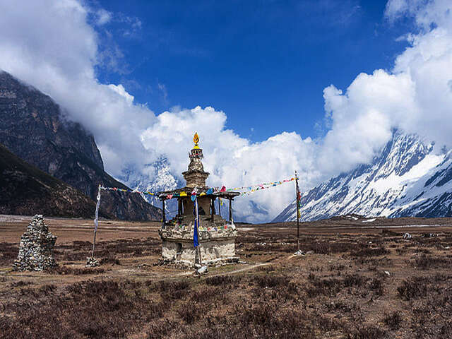
A small temple en route
Pass crossing (days 9 and 10). The group sleeps at Dharamsala before an early start for Larkya La. Departure is typically between 3 and 4 am. The day involves 8 to 10 hours of walking, a climb of about 700 m to the pass and a descent of nearly 1,500 m to Bimthang.
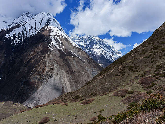
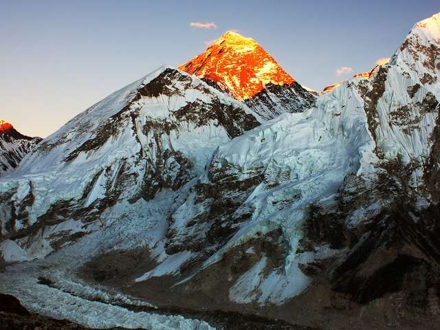
Mountain views on the trek
Descent (days 11 to 13). The trail follows the Dudh Khola and Marsyangdi valleys to Dharapani, where the road to Kathmandu begins.
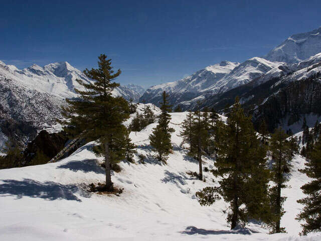
Looking back towards Manaslu
Permits and regulations
Manaslu is a restricted area. Independent trekking is not permitted. The required documents are:
- Manaslu Restricted Area Permit, issued only through a registered trekking agency
- Manaslu Conservation Area Project (MCAP) permit
- Annapurna Conservation Area Project (ACAP) permit for the final section
- A licensed guide for the full route, and a minimum of two trekkers on the permit
The restricted-area permit is charged per day and costs more between September and November than in other months. Fees and rules change, so please confirm current rates with us before booking.
Best time to trek
- October to early November: the most stable weather and clearest views. This is also the busiest period, so early booking is advised.
- March to May: warmer temperatures and rhododendron forest at lower altitudes, with occasional afternoon cloud.
- June to August: not recommended, because of monsoon rain, landslides and leeches on the lower trail.
- December to February: not recommended, because of severe cold and the risk of Larkya La closing in heavy snow.
Difficulty and preparation
Manaslu is more demanding than Everest Base Camp. The lower valley has steep ascents and descents, daily distances are long, and the highest pass comes late in the itinerary. The route is non-technical but requires solid fitness and sensible acclimatisation.
- Training: 8 to 12 weeks of hill walking with a 6 to 8 kg pack, combined with stair and cardio work.
- Acclimatisation: above 3,000 m, limit the increase in sleeping altitude to roughly 500 m per night and use the scheduled rest days.
- Altitude sickness: report headache, nausea, poor sleep or breathlessness to your guide immediately. Descent is the primary treatment.
- Medical advice: consult your doctor before the trek, particularly about altitude medication.
Equipment checklist
Overnight temperatures near Samdo and Larkya Phedi can reach -15 °C.
- Base layers, fleece, down jacket and windproof shell
- Broken-in waterproof trekking boots, warm socks and microspikes
- Sleeping bag rated to -15 °C (rentals available in Kathmandu)
- Warm hat, sun hat, gloves, sunglasses and sunscreen
- Water bottles, purification tablets, headlamp and trekking poles
- Nepali rupees in cash, as there are no ATMs along the upper route
For advice on equipment shopping, see our guide to buying cheap trekking gear in Kathmandu.
Frequently asked questions
Can I trek the Manaslu Circuit independently? No. The permit requires a licensed guide and a minimum of two trekkers.
How does Manaslu compare with the Annapurna Circuit? It is slightly harder. The route is more remote, teahouses are simpler and the lower section is rougher. Larkya La (5,160 m) is lower than Thorong La (5,416 m), but the approach is steeper and longer.
Is there mobile coverage and Wi-Fi? Coverage is limited. Some villages have a signal and paid Wi-Fi, but trekkers should expect to be offline for much of the route.
Can Indian citizens trek Manaslu? Yes. The same restricted-area permit and guide requirements apply. Contact us for the documents and fees that apply to Indian citizens.
Plan your Manaslu Circuit with Base Camp Hikes
Base Camp Hikes arranges restricted-area permits, licensed guides, porters, teahouse accommodation and transfers for the Manaslu Circuit, with small groups and a flexible acclimatisation plan. View the Manaslu Circuit trek or contact our team for departure dates and a tailored quote.