
 By
Nepal has two classic long-distance circuits that cross a pass above 5,000 m and take about two to three weeks. The Annapurna Circuit is the older and better known, with varied landscapes, established lodges and flexible start points. The Manaslu Circuit is the quieter and more remote of the two, running beside the world’s eighth-highest mountain, Manaslu (8,163 m), through valleys with a strong Tibetan Buddhist character. Both finish in about 18 days in our itineraries. They differ in terrain, culture, permits, comfort and cost, and this guide compares them in detail so you can choose with confidence.
Facts and figures reflect our own itineraries and published sources as of 13 October 2026. Permit fees, road conditions and prices change, so please confirm current details with us before booking.
At a glance
| Factor | Manaslu Circuit | Annapurna Circuit |
|---|---|---|
| Our itinerary | 18 days, Kathmandu to Kathmandu | 18 days, Kathmandu to Kathmandu |
| Route length | About 177 km | About 160 to 230 km, depending on where road transport is used |
| Highest point | Larkya La, about 5,100 m (published figures 5,106 to 5,160 m) | Thorong La, 5,416 m |
| Grade (our packages) | Fairly strenuous | Strenuous |
| Landscape | Deep river gorges, forest, high Tibetan-style valleys, glacial moraine | Subtropical valleys, pine forest, high desert and the Kali Gandaki gorge |
| Culture | Nubri and Tsum communities; Tibetan Buddhist monasteries, mani walls and kani gates | Gurung, Magar and Thakali villages; Tibetan-influenced Manang; Muktinath pilgrimage site |
| Trail traffic | Low; access is controlled by permits | Moderate to high |
| Lodges | Basic to moderate; some camping stages | Moderate to good |
| Permits | Restricted-area permit plus conservation permits; licensed guide required | Annapurna conservation permit; guide recommended |
| Roads | Few, but road building is advancing up the valley | Road reaches Manang and Muktinath; only the Thorong La and Poon Hill sections lack a road |
| Our package price | Rs. 140,000 all-inclusive | Rs. 90,000 all-inclusive |
| Best seasons | March to May; September to November | March to May; September to November |
Published figures for Larkya La run from 5,106 m to 5,160 m, and our own package page gives more than one value. Whichever you use, it is roughly 250 to 310 m lower than Thorong La.
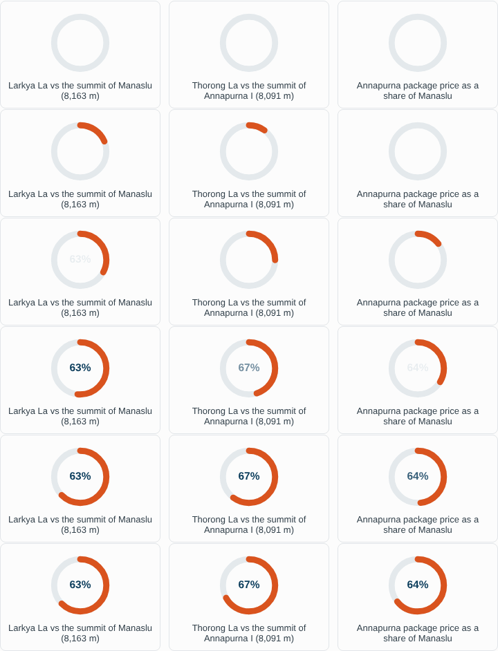
The two circuits in numbers
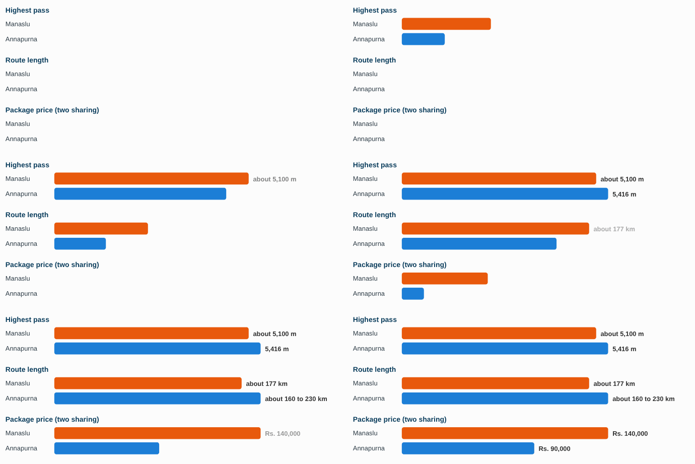
Each pair is scaled to its larger value. Route length for Annapurna depends on where road transport is used; the bar shows the midpoint of the published range. Prices are our all-inclusive package prices as of 13 October 2026.
Two different trekking worlds
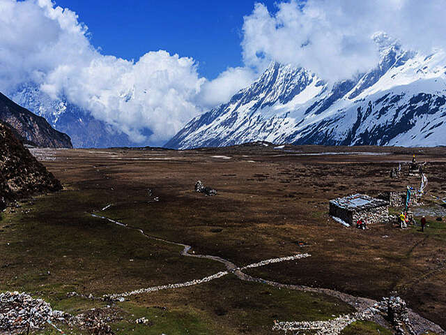
Manaslu Circuit: the remote valley
The trail follows the Budhi Gandaki river upstream from the hills of Gorkha and Arughat, climbing through six climatic zones from warm lower valleys to alpine terrain above 4,500 m. It lies inside the Manaslu Conservation Area, a protected region of about 1,663 sq km declared in the late 1990s, whose wildlife includes snow leopard, red panda, Himalayan tahr and blue sheep, though trekkers rarely see the rarer species. Foreign trekkers were first allowed on this route in 1991, and access is still controlled, which is why the trails are quieter.
The people of the upper valleys, the Nubri and Tsum, share Tibetan language and Buddhist customs. Expect long mani walls, chortens, prayer-flag lines, kani entry gates and monasteries such as the one at Sama Gompa. The route passes Samagaun at the foot of Manaslu, spends a rest day at Sama Gompa, then climbs through Samdo and Dharmashala to Larkya La before dropping to Bimtang and the Marsyangdi valley.
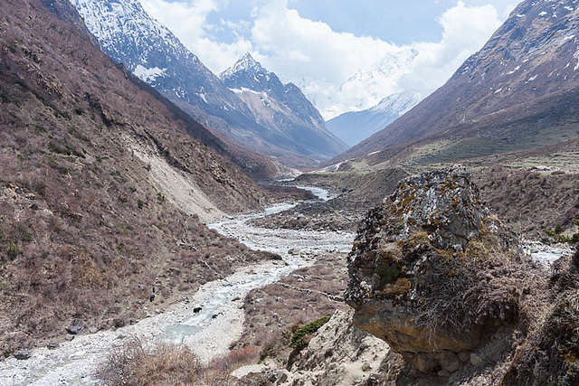
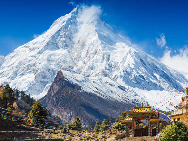
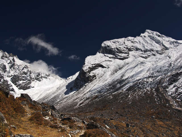
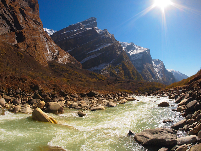
Trail views on the Manaslu Circuit
Annapurna Circuit: the classic loop
The Annapurna Circuit opened to foreign trekkers in 1977 and quickly became one of the world’s best-known treks. It climbs the Marsyangdi valley through terraced farmland and forest, crosses the dry, Tibetan-influenced Manang valley, and goes over Thorong La to Muktinath, a shrine that is sacred to both Hindus and Buddhists. It then descends the Kali Gandaki valley between the Annapurna and Dhaulagiri ranges, through Thakali villages such as Marpha, known for its apple orchards, to the hot springs at Tatopani. A climb to Poon Hill for sunrise finishes the walk.
Because much of the route lies in a rain shadow, the northern sections are far drier than the green southern slopes, which produces a more dramatic change of scenery than on Manaslu. The trade-off is road building, covered below.
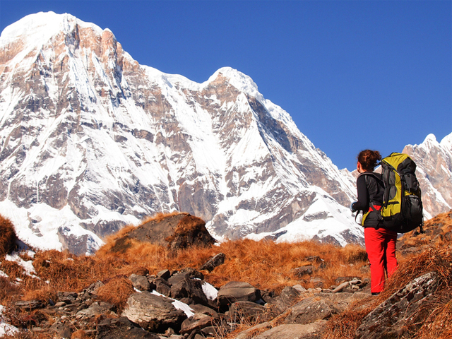
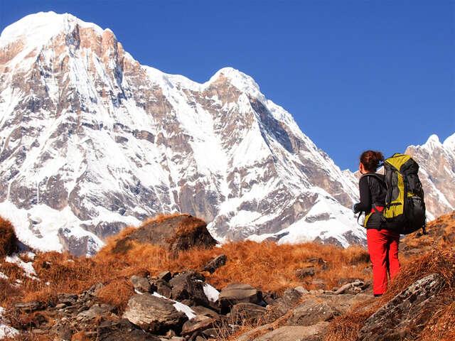
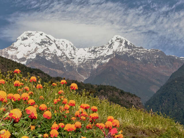
The Annapurna massif
Altitude profile, day by day
Day by day: sleeping altitude on both 18-day itineraries
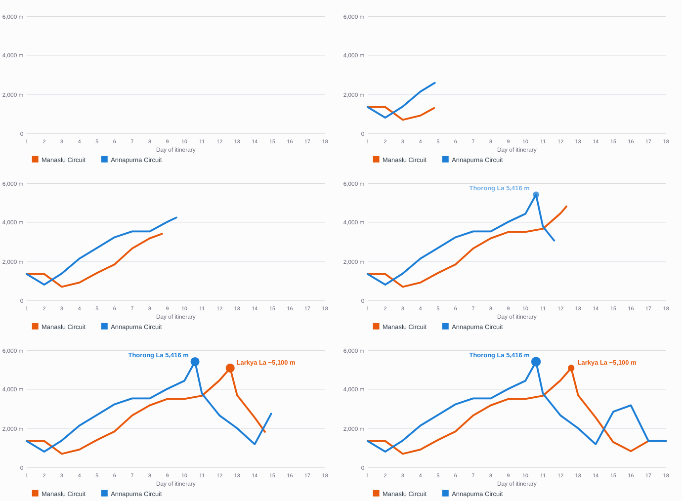
Built from the overnight altitudes in our two 18-day itineraries; pass heights are the day highs. Kathmandu days are shown at 1,350 m, and Soti Khola is approximate.
The two pass days compared (approximate)
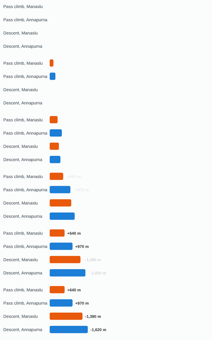
Climb: from the high camp to the pass (Dharmashala 4,470 m to about 5,106 m; Thorong Phedi 4,450 m to 5,416 m). Descent: from the pass to that night’s stop (Bimtang 3,720 m; Muktinath 3,800 m). Derived from our itineraries; the Larkya La figure is the commonly published one.
On pass day, Annapurna asks for the larger climb (about 970 m from Thorong Phedi) and a long descent to Muktinath, so the pass is a heavy day for the legs and lungs. Manaslu’s pass day is slightly smaller in climb but much longer overall, at about eight hours, and ends at Bimtang after a descent of roughly 1,390 m.
Your 18 days at a glance
Your 18 days at a glance
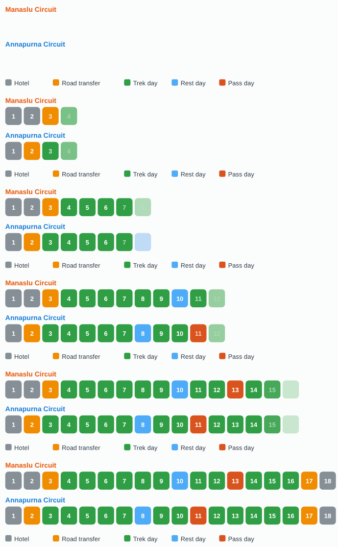
Manaslu: 11 trek days plus the pass day and one rest day. Annapurna: 12 trek days plus the pass day and one rest day. Both include two road days and hotel nights at each end.
Manaslu Circuit: day-by-day itinerary
| Day | Route | Overnight | Walking |
|---|---|---|---|
| 1 | Arrive in Kathmandu | Hotel | |
| 2 | Permit processing and briefing | Hotel | |
| 3 | Bus Kathmandu to Arughat and Soti Khola (about 8 hours) | Soti Khola | |
| 4 | Soti Khola to Machha Khola | 930 m | 6 to 7 hours |
| 5 | Machha Khola to Jagat | 1,410 m | 6 to 7 hours |
| 6 | Jagat to Dyang | 1,860 m | About 5 hours |
| 7 | Dyang to Namrung | 2,660 m | 5 to 6 hours |
| 8 | Namrung to Lhogaon | 3,180 m | About 4 hours |
| 9 | Lhogaon to Sama Gompa | 3,520 m | 3 to 4 hours |
| 10 | Rest and acclimatisation at Sama Gompa | 3,520 m | Optional |
| 11 | Sama Gompa to Samdo | 3,690 m | About 4 hours |
| 12 | Samdo to Dharmashala | 4,470 m | 4 to 5 hours |
| 13 | Dharmashala over Larkya La to Bimtang | 3,720 m | About 8 hours |
| 14 | Bimtang to Tilche | 2,560 m | About 5 hours |
| 15 | Tilche to Jagat (Marsyangdi valley) | 1,300 m | About 6 hours |
| 16 | Jagat to Bhulbhule | Lodge | |
| 17 | Bus to Kathmandu | Hotel | |
| 18 | Departure |
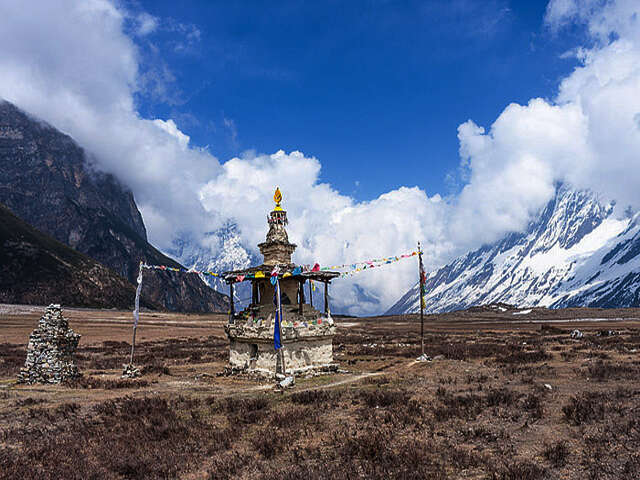
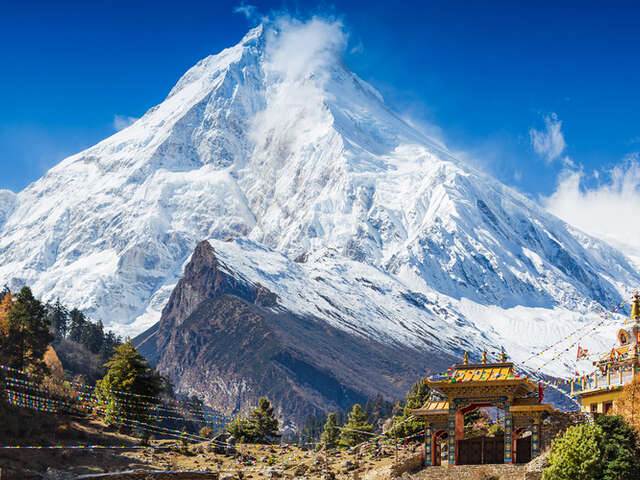
A small temple along the Manaslu Circuit
Annapurna Circuit: day-by-day itinerary
| Day | Route | Overnight | Walking |
|---|---|---|---|
| 1 | Arrive in Kathmandu; briefing | 1,350 m | |
| 2 | Drive Kathmandu to Besisahar | 820 m | 7 to 10 hours by road |
| 3 | Drive to Syange, walk to Chamje | 1,385 m | 5 to 6 hours |
| 4 | Chamje to Bagarchhap | 2,160 m | 6 to 8 hours |
| 5 | Bagarchhap to Chame | 2,710 m | 5 to 6 hours |
| 6 | Chame to Pisang | 3,250 m | 5 to 6 hours |
| 7 | Pisang to Manang | 3,540 m | 6 to 7 hours |
| 8 | Rest and acclimatisation at Manang | 3,540 m | Short walks |
| 9 | Manang to Yak Kharka | 4,050 m | 3 to 4 hours |
| 10 | Yak Kharka to Thorong Phedi | 4,450 m | 3 to 4 hours |
| 11 | Over Thorong La (5,416 m) to Muktinath | 3,800 m | 7 to 8 hours |
| 12 | Muktinath to Marpha | 2,670 m | 6 to 7 hours |
| 13 | Marpha to Ghasa | 2,010 m | 7 to 8 hours |
| 14 | Ghasa to Tatopani | 1,200 m | 7 to 8 hours |
| 15 | Tatopani to Ghorepani | 2,870 m | 7 to 8 hours |
| 16 | Poon Hill (3,200 m) at dawn, then Nayapul and Pokhara | Pokhara | 6 to 7 hours |
| 17 | Bus to Kathmandu | 1,350 m | 6 to 8 hours by road |
| 18 | Departure |
Times are approximate and depend on weather and trail conditions. Several altitudes in published sources differ by a few tens of metres, so treat the figures as a guide.
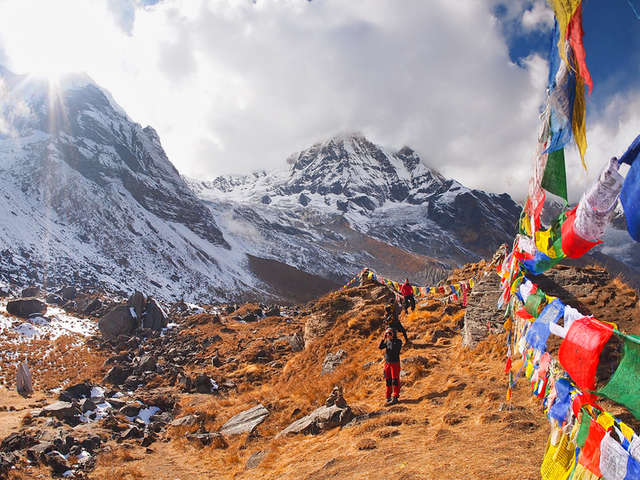
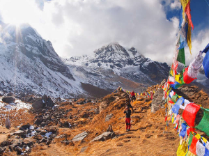
Prayer flags in the Annapurna region
Altitude and difficulty
Neither circuit needs technical skills, but both are demanding. The main hazards are altitude, long descents and cold weather on the pass.
- Annapurna. Thorong La is the higher pass, and the approach from Thorong Phedi (4,450 m) is steep. The usual plan is an alpine start around 4 am to cross before the afternoon wind builds. Afterwards come several consecutive 7 to 8 hour days of descent.
- Manaslu. The pass is lower, but the walking is more remote, trails are narrower and exposed in places, and rescue is slower because there is less road access and traffic. The pass day is among the longest of the trek.
- Acclimatisation. Both itineraries include a rest day (Sama Gompa on Manaslu, Manang on Annapurna). Above 3,000 m, limit the increase in sleeping altitude to roughly 500 m per night, drink plenty of water and never climb with worsening symptoms.
- Warning signs. Persistent headache, nausea, dizziness, unusual breathlessness, confusion or loss of balance mean you should tell your guide at once. Descent is the primary treatment.
- Training. 10 to 12 weeks of hill walking with a loaded daypack, plus stair work and cardio. Long back-to-back days are the best preparation.
Walking hours per day (midpoints of our stated ranges)
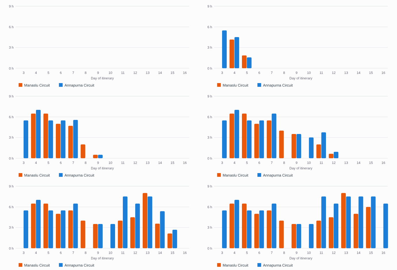
Rest days (Manaslu day 10, Annapurna day 8) and road days are left blank. Our Manaslu page gives no walking time for day 16 (Jagat to Bhulbhule). Annapurna asks for 7 to 8 hour days in a long run from day 11; Manaslu’s longest day is the 8-hour pass crossing.
Altitude exposure on our itineraries
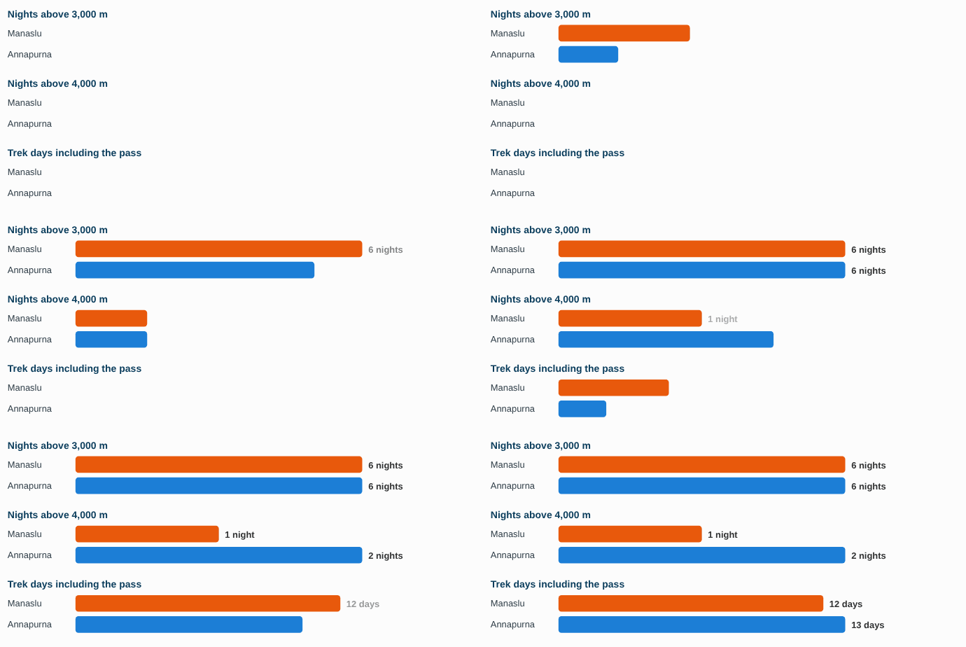
Counted from the overnight altitudes in the itinerary tables. Manaslu’s only night above 4,000 m is Dharmashala (4,470 m); Annapurna’s are Yak Kharka (4,050 m) and Thorong Phedi (4,450 m).
Permits and regulations
- Manaslu restricted-area permit. The route is a restricted area, so a permit must be arranged through a registered agency and the trek made with a licensed guide. Published rates are about USD 100 for the first seven days in September to November and about USD 70 to 75 in other months, with a daily charge afterwards. Reports say the former two-trekker minimum was dropped in March 2026, so solo trekkers can apply with a guide; please confirm the current rule with us.
- Manaslu Conservation Area permit. A separate entry permit, commonly quoted at about NPR 3,000. The route ends in the Annapurna region, so an Annapurna Conservation Area permit may also be required.
- Annapurna Conservation Area permit. Reported at NPR 3,000 for foreign nationals and NPR 1,000 for SAARC nationals. Permits bought at a checkpoint can cost twice as much. Reports say the TIMS card is no longer required, although our package lists it as included, so we confirm the current rule when we arrange your papers.
Fees and rules change, so please confirm them with us before booking. Indian citizens pay the SAARC rate for the Annapurna permit; please contact us for the documents and fees that apply.
Cost and what is included
| Item | Manaslu Circuit | Annapurna Circuit |
|---|---|---|
| Package price (two sharing) | Rs. 140,000 all-inclusive | Rs. 90,000 all-inclusive |
| Kathmandu and Pokhara hotels | 3 nights in Kathmandu with breakfast | 2 nights in Kathmandu and 1 in Pokhara with breakfast |
| Meals | All meals on the trek | 3 meals a day on 15 days |
| Guide and porter | Licensed English-speaking guide and porter service | Licensed English-speaking guide and porter service |
| Permits and taxes | Included | Included |
| Transport | Round-trip road transport from Kathmandu | Road transport, including Pokhara to Kathmandu by tourist bus |
| Bottled water | About INR 100 per litre low down, up to about INR 300 higher up | About INR 50 to 300 per litre, depending on altitude |
| Pocket money | About INR 1,000 per day suggested | About INR 1,000 per day suggested |
Insurance is mandatory on both treks, and tips for guides and porters are customary. If you are the only person booked on a departure, a solo surcharge of INR 1,500 per day applies, which is waived if others join before you arrive. The Manaslu route costs more because of the restricted-area permit, longer road transfers and more complex logistics.
Crowds, lodges and roads
Crowds. The Annapurna Circuit is much busier, especially around Manang and Thorong La, which supports a wider range of food, more dependable Wi-Fi and easier access to hot showers. Manaslu is quieter because permits restrict numbers, but its lodges are simpler, particularly above Samagaun, and there are fewer places to stay. On the busiest pass days, a shortage of beds can mean tents at high camps.
Roads. Road building has changed the Annapurna Circuit. Roads now reach Manang and Muktinath, and published accounts say only the Thorong La crossing and the Ghorepani and Poon Hill section, about two to three walking days in total, have no road. The marked Natural Annapurna Trekking Trails use side routes to avoid much of the road, and many trekkers shorten the trek by driving the lower stages. On Manaslu, far fewer roads exist, though construction is advancing up the Budhi Gandaki, so ask us for the current road-head.
Comfort. On Annapurna, expect comfortable lodges, attached bathrooms at lower altitudes and bakeries in Manang and Marpha. On Manaslu, expect basic rooms, shared toilets and simple menus, with some camping stages at Sama Gompa and Dharmashala. Ask us to confirm the arrangement for your departure.
Culture and highlights
| Manaslu Circuit | Annapurna Circuit |
|---|---|
| Sama Gompa monastery and the village of Samagaun below Manaslu | Manang village and the Gangapurna and Annapurna views |
| Kani gates, mani walls and chortens through the Nubri valley | Muktinath, a shrine sacred to Hindus and Buddhists |
| Samdo, the highest village in the valley | Marpha, famous for its apple orchards and whitewashed lanes |
| Larkya Glacier moraine and the crossing to Bimtang | The Kali Gandaki gorge, often described as one of the deepest valleys on Earth |
| Views of Manaslu, Himlung and Cheo Himal | Tatopani hot springs and Poon Hill sunrise over Dhaulagiri |
Comparing them: Annapurna offers variety within a single trek, while Manaslu offers immersion in one cultural and scenic world.
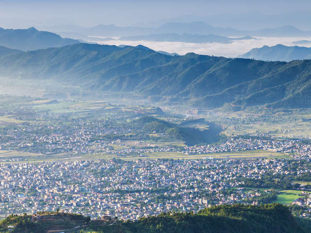
Pokhara seen from Sarangkot hill
Best time to trek
Best months for both circuits

General pattern for both routes. Always allow a spare day for weather on the pass.
| Season | What to expect |
|---|---|
| September to November | The most stable weather and clearest views. This is the busiest period, so book early. October is peak; November is quieter and colder. |
| March to May | Warmer, with rhododendron forest on lower trails and afternoon cloud. Snow can linger on the passes in early spring. |
| December to February | Cold with a risk of snow on the passes. Thorong La can close briefly, and Larkya La is not recommended in deep winter. |
| June to August | Not recommended on either route because of monsoon rain, leeches and landslides. The Annapurna trans-Himalayan section is drier but still affected. |
Late-season snow has caught trekkers on the Annapurna Circuit before. A blizzard in October 2014 killed more than 40 people, and heavy snow in late October 2025 led authorities in Myagdi and Mustang to halt treks. The lesson is the same for both circuits: build in a spare day, follow your guide’s decision on the pass, and never cross in poor conditions.
Route status in October 2026
●Route status reviewed 13 October 2026
Floods on 26 August 2026 damaged roads and bridges in the Trishuli and Bhotekoshi corridor. Operators relaying Nepal Tourism Board information report that damage on the Manaslu Circuit near Namrung has been repaired and the restriction lifted on 11 September 2026. On the Annapurna side, the Besisahar to Chame road was reported under repair in early October, and the Beni to Jomsom road was closed with reopening expected in mid-October. Please confirm current status with us before you travel.
Which trek should you choose?
| If you are… | We suggest | Why |
|---|---|---|
| Doing your first high-altitude circuit | Annapurna | Better lodges, simpler permits and flexible start points |
| Seeking solitude and a wilderness feel | Manaslu | Permit-controlled numbers and a remote valley |
| Interested in Tibetan Buddhist culture | Manaslu | Nubri villages, monasteries and mani walls |
| Wanting varied scenery in one trek | Annapurna | Forest, high desert, apple country and hot springs |
| Making a pilgrimage | Annapurna | Muktinath is sacred to Hindus and Buddhists |
| On a tighter budget | Annapurna | Lower package price and no restricted-area permit |
| Comfortable with simple lodges and long days | Manaslu | The reward is quiet trails and big mountain scenery |
| Short of time | Annapurna | The route can be shortened by road, which Manaslu does not allow as easily |
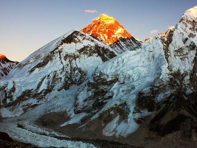
Our view. Choose Annapurna for variety, comfort and flexibility. Choose Manaslu for quiet trails, culture and a feeling of remoteness. If you can, do the more remote trek first while your legs are strongest, and the other one on a later trip. If your priority is Everest instead, read our complete Everest Base Camp guide.
Our packages
Frequently asked questions
Which is harder, Manaslu or the Annapurna Circuit? They are close. Thorong La is higher with a steeper approach, while Manaslu is more remote, with simpler lodges and fewer rescue options. Our packages grade Manaslu as fairly strenuous and Annapurna as strenuous, and some operators rate Manaslu slightly harder overall.
Do I need a guide for each trek? A licensed guide is mandatory on the Manaslu Circuit. On the Annapurna Circuit it is not mandatory under the rules reported for 2026, but we recommend one for the pass and for altitude decisions.
Which is more crowded? The Annapurna Circuit. Manaslu permits limit numbers, so its trails stay quiet even in peak season.
Which is better for a first high-altitude trek? The Annapurna Circuit is usually easier to manage, with better lodges, simpler permits and flexible start points.
Is Annapurna still worth doing with the roads? Yes. Roads affect the lower sections, but the Manang valley, Thorong La and Kali Gandaki scenery remain outstanding, and side trails avoid much of the traffic. Many trekkers also drive the lower stages to save time.
How much altitude do the treks reach? Larkya La on Manaslu is about 5,100 m and Thorong La on Annapurna is 5,416 m. Both itineraries include a rest day to acclimatise.
What is the best month for each trek? October and November offer the most stable weather on both routes, and March to May is the main alternative.
Can Indian citizens do both treks? Yes. The same permit and guide rules apply. Contact us for the documents and fees that apply to Indian citizens.
Which costs more? Manaslu, mainly because of the restricted-area permit and logistics. Our packages are Rs. 140,000 for Manaslu and Rs. 90,000 for Annapurna.
Plan your trek with Base Camp Hikes
Base Camp Hikes arranges permits, licensed guides, porters, accommodation and transfers for both circuits, in small groups with a flexible acclimatisation plan. See the Manaslu Circuit trek or the Annapurna Circuit trek, or contact our team for departure dates and a quote.