By
Thorong La is the high point of the Annapurna Circuit at 5,416 m, higher than Everest Base Camp at 5,364 m. Most trekkers cross it from east to west, from Manang to Muktinath, starting from Thorong Phedi or High Camp at about 3 to 4 am to avoid the afternoon wind. The climb is long and gradual rather than technical, but the altitude, cold and the steep descent of roughly 1,700 m to Muktinath make it a serious day. This guide explains the route, a pass-day timeline, the best season, how to acclimatise, what to pack and when to turn back.
Thorong La in short
- Height: 5,416 m, the highest point of the Annapurna Circuit.
- Direction: east to west, Manang to Thorong Phedi to Muktinath, for better acclimatisation.
- Start time: about 3 to 4 am, to cross before the wind rises.
- Descent: roughly 1,700 m down to Muktinath, which is hard on the knees.
- Best months: late September to November and March to May. Winter snow can close the pass.
- Key rule: acclimatise in Manang, and turn back if symptoms or weather turn bad.
Last checked: 28 October 2026. Road works, snow and lodge services change from year to year, so confirm current details with your operator and guide.

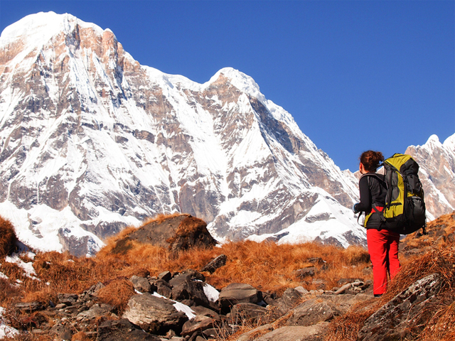
The colourful Thorong peak near the pass.
In this guide: Route | Manang | Pass day | Descent | Season | Acclimatisation | Gear | Shorter options | FAQ
What is the route to Thorong La?
The Annapurna Circuit starts at Besisahar or a little further along the road, and heads up the Marsyangdi valley to Manang. Roads now cover much of the lower part of the circuit, but the stretch from Manang over the pass to Muktinath remains the most remote part of the trek, with no road crossing it. The sequence for the pass section is below.
| Stage | Approx. altitude | What it is like |
|---|---|---|
| Manang | About 3,540 m | Village with day walks, the main acclimatisation stop |
| Yak Kharka | About 4,000 m | A quiet pasture village with views of Chulu West, one of Nepal’s trekking peaks |
| Thorong Phedi | About 4,450 m | A cluster of lodges at the foot of the pass |
| Thorong High Camp | About 4,800 to 4,900 m | A steep climb above Phedi with basic lodges |
| Thorong La | 5,416 m | The pass, with prayer flags and a wide panorama |
| Muktinath | About 3,710 m | A pilgrimage village and the end of the pass day |
The trail beyond Yak Kharka passes over a long suspension bridge across the upper Jarsang Khola and then climbs a steep-walled valley where avalanches are a risk after heavy snow. Check conditions with your guide.

A suspension bridge on the approach to the pass.
Why is Manang so important before the pass?
Manang is where most trekkers acclimatise. It sits at about 3,540 m and has short day walks to viewpoints above the village. Spending a rest day here, and walking high before sleeping low, is the best way to prepare for the pass. If you travel by jeep to Manang, which is possible on the road, the trek is shorter and you have less time to adjust, so plan at least two or three nights in Manang before you continue. Views of Annapurna III and Gangapurna from here are among the best of the trek.

On the trail toward Manang.
What does the pass day look like?
The day is long and cold. A typical schedule is below, and your guide will adjust it for weather and how the group feels.
| Time | What happens |
|---|---|
| Evening before | Early dinner at Thorong Phedi or High Camp, pack warm layers and charge head torches |
| 3:00 to 4:00 am | Start in the dark with head torches. It is cold, and the early start avoids the afternoon wind |
| 4:30 to 6:00 am | Climb steeply to High Camp, if you slept at Phedi. Trail then eases into a long, gradual ascent |
| Dawn | Cold and clear, with the first light on the peaks. A good time to drink warm fluids |
| Several hours on | The pass can look close, but there are several false ridges and moraines before the real top |
| Mid-morning | Reach Thorong La at 5,416 m. Take photos, add a warm layer, and do not stay long |
| After the pass | A long, steep descent of roughly 1,700 m to Muktinath. Poles help your knees |
| Afternoon | Arrive at Muktinath, tired. Some trekkers stop earlier at a quieter village if the legs are spent |
Most trekkers need around 9 to 11 hours from Thorong Phedi to Muktinath. Starting from High Camp shortens the climb, but it means sleeping higher, so it is a choice to make with your guide based on how you feel.
Phedi or High Camp for the night before?
Thorong Phedi has better lodging and keeps you lower for the night, which helps avoid altitude problems. High Camp makes the pass day shorter, but sleeping higher can be harder for some people. If you are well, have no headache and have followed the standard schedule, High Camp can make the following day easier. If you feel unwell, stay lower.

Annapurna III (7,555 m) from Manang.
How hard is the descent to Muktinath?
The descent is longer and steeper than most people expect. You lose about 1,700 m in a few hours, on a trail that is rocky and can be icy at the top. Use trekking poles, take short steps and keep a steady pace. Views of the Mustang region and Dhaulagiri open up as you come down. If your legs are tired, the quieter village of Chhabarbu is about an hour above Muktinath and can be a calmer place to rest. Muktinath is a pilgrimage site, and the temple above the village is worth a visit. Hindu and Buddhist pilgrims come here from far away, and visitors should be respectful.
After Muktinath, the trek continues down the Kali Gandaki valley, one of the deepest gorges in the world, toward Jomsom. From Jomsom you can fly to Pokhara or continue by road. Read the Annapurna Circuit guide.
What is the best season for Thorong La?
| Months | Conditions on the pass | Crowds | Notes |
|---|---|---|---|
| September to November | Settled weather and clear views, busiest in October | High | Best overall for views and stability |
| December to February | Cold, with heavy snow possible. The pass can close for days | Low | Be ready to turn back. Avalanche and whiteout risk |
| March to May | Pleasant weather, a small chance of snow in March and April | Moderate | A good alternative to autumn |
| June to August | The pass area lies in a rain shadow, though lower sections get rain | Low | One of the few trekking options in the monsoon |
The Chame to Jomsom stretch lies in the rain shadow of the Annapurna range, so it is far drier than most of Nepal in summer. Wildflowers can be good. See the Annapurna trekking options for other routes.
How do you acclimatise for Thorong La?
- Go slowly: do not rush the climb from Besisahar to Manang. A gradual rise helps your body adapt.
- Take a rest day in Manang: and walk higher during the day, then sleep lower.
- Drink water: and eat regular meals even if your appetite is low.
- Report headaches: early to your guide. A worsening headache, vomiting, poor balance or confusion means stop and descend.
- Do not cross with symptoms: and be willing to turn back if the weather or your health turns bad.
- Cross east to west: crossing in the other direction, from Muktinath, gives too little time to adjust unless you have spent a couple of nights at height first.
Read the altitude sickness guide. Training also helps. See the 12-week training plan.
What should you pack for the pass?
| Item | Why |
|---|---|
| Warm down jacket, hat, gloves and a face cover | Pre-dawn temperatures at altitude are well below freezing |
| Thermal layers and a windproof shell | Wind rises later in the morning |
| Head torch with spare batteries | The start is in the dark |
| Sunglasses and sunscreen | Strong sun and snow glare at 5,000 m |
| Trekking poles | Balance on the climb and relief on the long descent |
| Microspikes if snow is expected | Ice on the upper trail |
| Water in an insulated bottle | Water can freeze in a bottle on the outside of your pack |
| Snacks | Energy on a 9 to 11 hour day |
| Medicines and blister kit | Personal care without delay |
Read the packing checklist for a longer list that also fits the Annapurna Circuit.
Is there a shorter way to cross Thorong La?
Yes, by taking a jeep to Manang and crossing after a couple of rest days, then flying from Jomsom to Pokhara, you can complete the pass in as little as eight days round trip from Kathmandu. This suits only experienced trekkers who have been at altitude before and are ready to turn back if symptoms appear, because the schedule leaves little time to acclimatise. Most trekkers choose a longer schedule, such as the 18-day Annapurna Circuit or the 16-day circuit with Tilicho Lake. For cost and an itinerary, read the Annapurna Circuit cost and itinerary from India.
What about permits, insurance and connectivity?
- Permits: the circuit needs a conservation area permit and a TIMS card, which your operator arranges. Check current fees on the Nepal Tourism Board site.
- Insurance: the policy must cover trekking to at least 5,500 m, with helicopter evacuation. See the insurance guide.
- Connectivity: Wi-Fi and mobile signal are available in Manang and some other villages, and are limited at Thorong Phedi and High Camp. Plan to be offline for the pass day.
- Cash: carry enough Nepali rupees for the trek, since cash machines are limited.
How does Thorong La compare with other treks?
At 5,416 m, Thorong La is higher than Everest Base Camp but with a less crowded trail and a longer approach. For a comparison with other circuits, read Manaslu Circuit vs Annapurna Circuit and Everest Base Camp vs Annapurna Base Camp.
FAQ
How high is Thorong La? 5,416 m, the highest point of the Annapurna Circuit.
Is Thorong La higher than Everest Base Camp? Yes. Base Camp is 5,364 m and Thorong La is 5,416 m.
How hard is the Thorong La crossing? It is not technical, but it is long, cold and at high altitude, followed by a steep descent. Fitness and acclimatisation matter most.
How long does the pass day take? Usually 9 to 11 hours from Thorong Phedi to Muktinath.
Why start so early? To cross before the strong afternoon wind and to have enough daylight for the descent.
Should I stay at Thorong Phedi or High Camp? Phedi is lower and has better lodging. High Camp shortens the pass day but is higher. Choose with your guide.
Which direction is better? East to west, from Manang to Muktinath, because it allows better acclimatisation.
When is the best time to cross? Late September to November and March to May. Winter snow can close the pass.
Can I cross Thorong La in winter? Sometimes, but heavy snow can close the pass for days. Be ready to turn back.
Can I trek the Annapurna Circuit in the monsoon? It is one of the better monsoon options, since the pass section lies in a rain shadow, though the lower parts get rain.
How many days do I need to acclimatise in Manang? At least one rest day, and two or three nights if you came by jeep.
Do I need a guide? A guide helps with weather, acclimatisation and the decision to turn back. Many operators include one.
Do I need microspikes? If snow or ice is expected, yes. Ask your operator in advance.
Is there internet on the pass section? Limited. Manang has connectivity, and Thorong Phedi and High Camp are limited.
What does the trek cost? See the Annapurna Circuit cost guide. The 18-day package starts in Kathmandu.
Cross Thorong La with Base Camp Hikes
For dates and a quote, see the 18-day Annapurna Circuit, or message the team on WhatsApp or phone at +91 932 595 1234 (9 am to 7 pm IST), write to info@basecamphikes.com, or use the enquiry form.
Sources
- Nepal Tourism Board: safety in the mountains