 By
Nepal’s best-known high passes are Thorong La (5,416 m) on the Annapurna Circuit, Larkya La (about 5,106 m) on the Manaslu Circuit, and Kongma La, Cho La and Renjo La in the Everest region. All five are walking passes, not climbing routes, but each one is a long day above 5,000 m where altitude, cold and an early start decide how it goes. This guide compares them by height, character, season and permits, so you can choose the right pass for your fitness, time and budget.
Nepal’s high passes at a glance
- Highest: Kongma La, about 5,535 m, on the Everest Three Passes trek.
- Most straightforward: Thorong La, 5,416 m. Long and gradual rather than technical, with lodges on both sides.
- Quietest: Larkya La on the Manaslu Circuit, which needs a restricted-area permit and a licensed guide.
- One pass in the fewest days: Gokyo and Renjo La, a 14-day package.
- Best months: late September to November and March to May. Winter snow can close passes.
Last checked: 31 October 2026. Pass heights are rounded and differ between maps and sources. Fees, snow and lodge services change from year to year, so confirm them for your dates.
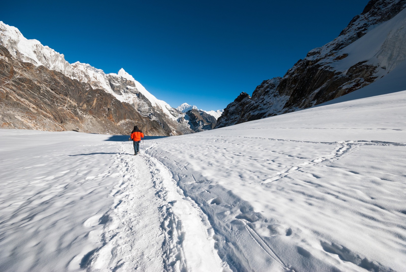
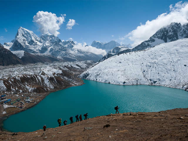
Cho La in snow. The passes are walking routes, but snow and ice change the day.
In this guide: The passes compared | Thorong La | Larkya La | Everest passes | Low passes | Difficulty | Which pass? | Pass day | Turn-back rules | Gear | Permits and fees | FAQ
Nepal’s high passes compared
| Pass | Height | Trek | Character | Our package |
|---|---|---|---|---|
| Thorong La | 5,416 m | Annapurna Circuit | Long, gradual climb; 9 to 11 hour day; many lodges | 18 days, Rs 100,000 (Annapurna Circuit) |
| Larkya La | About 5,106 m | Manaslu Circuit | Rocky moraine, snow in places; remote and quiet | 18 days, Rs 140,000 (Manaslu Circuit) |
| Kongma La | About 5,535 m | Everest Three Passes | Highest of the main passes; the hardest crossing | 20 days, Rs 120,000 (Three Passes) |
| Cho La | About 5,420 m | Three Passes, or Base Camp with Gokyo | Glacier crossing; ice and snow are common | Included in the Three Passes and Gokyo trips |
| Renjo La | About 5,360 m | Three Passes, or Gokyo and Renjo La | Wide views over Gokyo; a long descent to Thame | 14 days, Rs 90,000 (Gokyo and Renjo La) |
Heights: the Nepal Tourism Board gives Thorong La as 5,416 m, and the Department of National Parks and Wildlife Conservation gives Larkya La as 5,106 m. The Nepal Tourism Board’s trekking page lists Larkya La at 5,160 m, so published figures differ by about 50 m. The Everest pass heights are commonly quoted, rounded values and also vary by source. Prices are per person on two sharing, as listed on our package pages.
Thorong La: the Annapurna Circuit pass
Thorong La is the high point of the Annapurna Circuit and sits above Everest Base Camp (5,364 m). Most trekkers cross it from east to west, from Manang to Muktinath, which gives a better acclimatisation profile. The climb is long and gradual rather than technical, but the day is serious: you leave Thorong Phedi or High Camp at about 3 to 4 am, walk for 9 to 11 hours and then drop roughly 1,700 m to Muktinath. Manang, at about 3,540 m, is the place to spend a rest day before you go up.
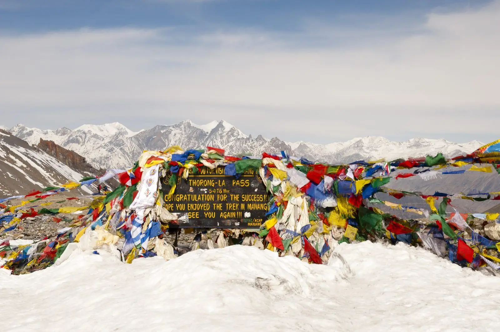
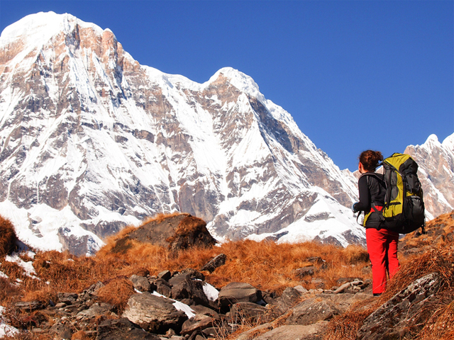
The Thorong peak near the pass.
Thorong La suits a first high-pass trek: the trail is wide, lodges on both sides serve hot food, and help is closer than on remote passes. Winter snow can close it. Our full route, timing and turn-back rules are in Crossing Thorong La on the Annapurna Circuit.
Larkya La: the Manaslu Circuit pass
Larkya La is about 5,106 m. Pass day starts at 3 to 4 am from Dharmashala and takes 8 to 10 hours: a climb of roughly 640 m to the top, then a knee-testing descent of about 1,390 m to Bimtang. The ground is rocky moraine with snow in places, and wind and cold are the main problems. Night temperatures at Samdo and Dharmashala can fall to about -15 C.
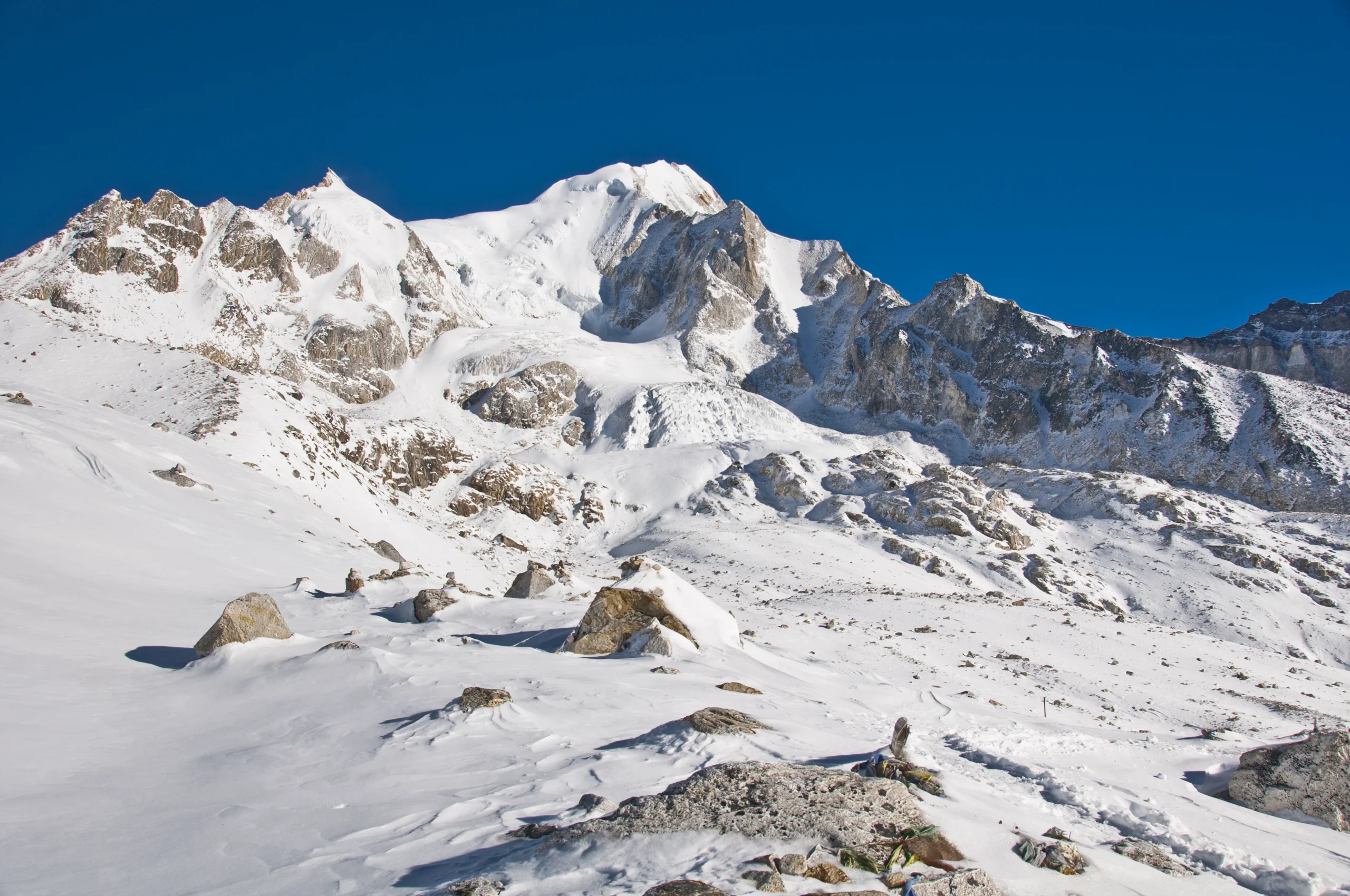
Larkya Pass (5135 m), Manaslu Himal,
The upper Budhi Gandaki valley is a restricted area, so access is controlled and trails are quieter than on the Annapurna or Everest routes. The trade-off is paperwork: you need a restricted-area permit through a registered agency, and a licensed guide. See the Manaslu Circuit guide for the route and Manaslu vs Annapurna Circuit for a side-by-side comparison of the two pass days.
The Everest passes: Kongma La, Cho La and Renjo La
Three passes in the Khumbu cross the high country between its main valleys. Together they make the 20-day Three Passes trek, which also visits Everest Base Camp, Kala Patthar and the Gokyo Lakes.
- Kongma La (about 5,535 m): the highest and hardest of the three, linking the Chhukung valley with Lobuche. It is a steep, long day on rocky ground, with a glacier section.
- Cho La (about 5,420 m): links the Dzongla side with the Gokyo valley. Ice on the glacier crossing is the issue, so microspikes and poles are useful in most seasons.
- Renjo La (about 5,360 m): joins Gokyo and Thame, with wide views back over the Gokyo lakes. The Nepal Tourism Board mentions it as a popular route to the Sherpa villages of Thamo and Thame.

The trail to Renjo La.
You do not have to do all three. The Gokyo and Renjo La trek crosses one pass in 14 days, and the Base Camp and Gokyo trek crosses Cho La. Read the Three Passes guide for the full loop and Everest Base Camp routes compared to see how the options differ.
Low passes: crossing without the altitude
Not every pass is a high-altitude challenge. On the Jiri route to Everest, the highest point before Lukla is Lamjura pass at 3,530 m, according to the Nepal Tourism Board. The route has long ridge climbs but no day above 5,000 m until the upper Khumbu. Our 22-day Jiri trek (Rs 120,000) suits trekkers who want a walk-in without flights and a slower build-up to altitude.
Which pass should you choose?
| If you want | Pick | Why |
|---|---|---|
| Your first high pass | Thorong La | Wide trail, many lodges, no technical ground |
| Few other trekkers | Larkya La | Restricted area, so fewer people |
| One pass and a shorter trip | Gokyo and Renjo La | 14 days, one pass, lake views |
| The biggest challenge | Three Passes (Kongma La, Cho La, Renjo La) | Three crossings above 5,300 m in 20 days |
| A long walk with no big pass | Jiri route (Lamjura, 3,530 m) | Slow build-up, no technical ground |
Crossing a pass safely
- Start early. Wind rises in the afternoon, so most pass days begin at 3 to 4 am.
- Acclimatise first. Take the rest days built into the itinerary, at Manang, Samdo or Gokyo, before going up. See altitude sickness on the Everest trek for symptoms and what to do.
- Keep spare days. Snow or wind can close a pass for a day. Leave one or two buffer days.
- Know when to turn back. Worsening altitude symptoms or a storm are reasons to go down, not push on. Your guide makes this call.
- Carry the right gear: microspikes if snow is expected, trekking poles, an insulated water bottle (water freezes outside the pack), a warm layer and sunglasses.
- Check your insurance. It must cover trekking to at least 5,500 m, including helicopter evacuation. See trek insurance for Indian travellers.
Training matters more than gear: several weeks of hiking with a loaded pack. Our training guide applies to every pass on this list. The Nepal Tourism Board’s mountain-safety page covers the basics of altitude and cold.
How hard is each pass, really?
This is our own guide rating, based on how our guides describe these days. It compares the passes with each other and is not an official grade.
| Pass | Pass-day length | Snow and ice risk | Remoteness | Ease of turning back |
|---|---|---|---|---|
| Thorong La | Very long (9 to 11 hours) | Moderate; can close in winter | Low: lodges both sides | Easy, with lodges close below |
| Larkya La | Long (8 to 10 hours) | Moderate to high | High: restricted valley | Harder; help is a day or more away |
| Kongma La | Long and steep | Moderate; glacier section | Medium | Harder once on the glacier side |
| Cho La | Medium, with a glacier crossing | High; ice most seasons | Medium | Moderate |
| Renjo La | Long, with a big descent | Low to moderate | Medium | Moderate |
A pass day, hour by hour
Every high-pass day follows the same shape, and knowing it takes the surprise out of it.
| Time | What happens | Why it matters |
|---|---|---|
| 3 to 4 am | Wake, tea, headtorch on, set off | You want to be over the top before the afternoon wind |
| First 2 to 3 hours | Steady climb in the dark and cold | Go slowly; sweating now means shivering at the top |
| Sunrise | Light and first warmth; snack stop | Drink and eat before you feel you need to |
| Mid-morning | Summit of the pass; photos, a few minutes only | Cold and thin air: do not linger |
| Late morning to afternoon | Long descent to the next lodge | Knees and concentration are the problem, not breathing |
| Evening | Rest, warm food, plenty of fluids | Skip alcohol; watch for a headache that gets worse |
Turn-back rules we use
The pass will still be there next year. These are the situations where our guides stop the group or turn it around:
- A headache that gets worse after rest, with nausea, vomiting or loss of balance.
- Heavy snowfall the night before, or whiteout on the trail. Wait a day if you have the buffer.
- Strong wind that makes it hard to stand or keep the group together.
- A trekker who is much slower than the plan. A pass day that runs past mid-afternoon is a bad idea.
- Any trekker who cannot walk in a straight line or think clearly: descend straight away.
Five mistakes that ruin a pass day
- Skipping the acclimatisation day to save a day on the itinerary.
- Starting too late. A 6 am start puts you on the top in the afternoon wind.
- Going too fast at the start. The steep part comes first, so pace yourself early.
- Not drinking. Dehydration feels like altitude sickness and makes it worse.
- Cheap gloves and boots. Cold hands and wet feet end more pass days than fitness does.
What to carry for a pass day
| Item | Why |
|---|---|
| Insulated gloves plus a spare pair | Hands lose feeling first at the top |
| Down jacket and a windproof shell | Wind chill on the top is far colder than the thermometer |
| Headtorch with spare batteries | You walk the first hours in the dark |
| Microspikes (rent in Manang, Lukla or Namche if needed) | Ice on Cho La and snowy approaches |
| Trekking poles | Take load off knees on the long descents |
| Insulated bottle or a bottle cover | Water freezes in the pack |
| Glacier sunglasses and sunscreen | Snow glare causes snow blindness |
| Sugar snacks you like | Appetite drops with altitude |
Permits and fees
Fees below are from the Nepal Tourism Board, per person. They change, so confirm the current figure before you book. Children under 10 pay no park entry fee. SAARC nationals, including Indian citizens, pay a lower rate, which the Nepal Tourism Board publishes separately and has revised over the years, so we confirm it at booking.
| Area | Foreigners (per entry) |
|---|---|
| Annapurna Conservation Area (Thorong La) | NPR 3,000 |
| Manaslu Conservation Area (Larkya La) | NPR 3,000 (listed in the fee table) |
| Sagarmatha National Park (Everest passes) | NPR 3,000 (SAARC: NPR 1,500) |
The Nepal Tourism Board’s fee table lists Manaslu Conservation Area at NPR 3,000 for foreigners, while its separate page on the conservation area lists NPR 2,000, so we confirm the figure when we arrange permits. Two more permits apply:
- Manaslu restricted-area permit: US$100 for the first week and US$15 a day after that from September to November; US$75 and US$10 a day from December to August.
- Khumbu Pasang Lhamu local permit (Everest region): reported at NPR 3,000, issued in Lukla.
The Annapurna Circuit also needs a TIMS card, which your operator arranges. A restricted-area permit is only issued through a registered agency, so you cannot buy the Manaslu permit yourself.
FAQ
What is the highest trekking pass in Nepal? Among the main teahouse-trek passes, Kongma La at about 5,535 m on the Three Passes trek. Higher technical passes exist, but they need climbing gear and are outside this guide.
Which high pass is the easiest? Thorong La is the most straightforward. The climb is long and gradual and there are lodges on both sides, but it is still a 9 to 11 hour day above 5,000 m.
How high is Thorong La? 5,416 m, according to the Nepal Tourism Board. It is the high point of the Annapurna Circuit.
How high is Larkya La? The Department of National Parks and Wildlife Conservation lists 5,106 m. The Nepal Tourism Board lists 5,160 m on its trekking page, and many sources round to about 5,100 m.
Do I need a permit for Larkya La? Yes. The Manaslu area needs a restricted-area permit through a registered agency, plus the conservation area entry permit. A licensed guide is required.
Can I cross a pass without a guide? The Annapurna Circuit is an open route, but we recommend a guide. Manaslu requires a licensed guide, and for the Everest passes a guide is strongly recommended because snow and ice change the route.
When is the best time to cross a high pass? Late September to November and March to May. Winter snow can close the passes, and the monsoon is not recommended.
How early do pass days start? At about 3 to 4 am for Thorong La and Larkya La, so you cross before the afternoon wind.
What if a pass is closed by snow? You wait a day at the lodge or turn back. Keep one or two spare days in the plan.
Do I need crampons? Usually not. Most crossings need microspikes and poles. After heavy snow your guide decides what is needed.
How fit do I need to be? You need several weeks of training, including hiking with a loaded pack. The days are long and the altitude is high even on the easier passes.
How much do pass treks cost? Our package pages list Rs 90,000 for Gokyo and Renjo La (14 days), Rs 100,000 for the Annapurna Circuit (18 days), Rs 120,000 for the Three Passes (20 days) and Rs 140,000 for the Manaslu Circuit (18 days), per person on two sharing. Prices can change, so confirm before you book.
Plan a pass trek with Base Camp Hikes
For dates and a quote, message the team on WhatsApp or phone at +91 932 595 1234 (9 am to 7 pm IST), write to info@basecamphikes.com, or use the enquiry form.
Sources
- Nepal Tourism Board: park entry fees
- Nepal Tourism Board: trekking permits and restricted areas
- Nepal Tourism Board: Annapurna region (Thorong La)
- Nepal Tourism Board: top trekking destinations (Larkya La)
- Nepal Tourism Board: Manaslu Conservation Area
- Nepal Tourism Board: Gokyo valley (Lamjura pass)
- Department of National Parks and Wildlife Conservation: Manaslu Conservation Area (Larkya La)
- Nepal Tourism Board: safety in the mountains