By
Everest Advance Base Camp, on the Tibet side of the mountain, sits at about 6,500 m, higher than any camp on the Nepal trek. It is the staging point for climbers on the North Col route, and for decades it was described as the world’s highest trek on an established trail. This guide explains where it is, how the route works, who can actually go there today, and which Nepal-side treks give the closest alternative.
The short answer
- Where: the north side of Everest, in Tibet, reached by road from Lhasa. It is not the Everest Base Camp trek in Nepal.
- Height: Advance Base Camp is at about 6,500 m, above the mountaineering base camp at about 5,200 m.
- Access today: Chinese authorities have closed the core zone, including the base camp area, to ordinary tourists, who can go as far as Rongpo Monastery at about 5,000 m.
- Who goes higher: permitted climbing expeditions.
- Nepal alternative: Everest Base Camp at 5,364 m and Kala Patthar at 5,545 m, open to trekkers without a climbing permit.
Last checked: 26 October 2026. Access rules in Tibet change, so confirm them with a licensed operator before planning.

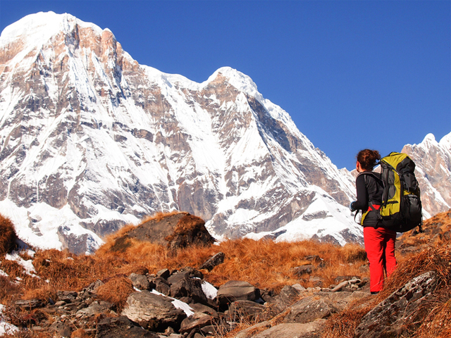
Khartaphu peak and Everest Advance Base Camp on the north side of the mountain.
In this guide: Camps at a glance | The route from Lhasa | Rongbuk to Advance Base Camp | Who can go today | Tibet permits | History | The Nepal alternative | FAQ
Everest’s camps at a glance
| Camp | Side | Altitude | Who can reach it |
|---|---|---|---|
| Everest Base Camp (trekking) | Nepal | 5,364 m / 17,598 ft | Trekkers, with standard trekking permits |
| Kala Patthar viewpoint | Nepal | 5,545 m / 18,192 ft | Trekkers |
| Rongpo Monastery and tourist tent camps | Tibet | About 5,000 m / 16,400 ft | Ordinary tourists on permitted tours |
| Mountaineering base camp | Tibet | About 5,200 m / 17,000 ft | Permitted climbing teams and staff |
| Advance Base Camp | Tibet | About 6,500 m / 21,300 ft | Permitted climbing teams |
The two Tibet base camps are about 3 km apart, according to Xinhua. Heights in feet are converted from the metre figures.
The road from Lhasa

The overland route from Lhasa climbs over high passes toward the Rongbuk valley.
The journey starts in Lhasa, at about 3,650 m, the capital of Tibet. Visitors normally spend a few days there to acclimatise, and Lhasa has plenty to see, including the Potala Palace, the Jokhang Temple, Barkor Square and the great monasteries of Sera, Drepung and Ganden. The overland drive to the Everest area is about 600 km and is normally spread over three days, both to see the sights and to protect against altitude sickness.
| Stage | Typical content |
|---|---|
| Day 1 | Lhasa to Gyantse, via the turquoise Yamdrok Lake and high passes of about 5,000 m, with views of the Nojin Kangtsang massif above 7,000 m. Gyantse is known for its hilltop fortress |
| Day 2 | Gyantse to Shigatse, home of the Tashilhunpo Monastery, and on toward the Tingri area, where the reserve entry tickets are bought |
| Day 3 | The road crosses Pang La, at about 5,200 m, with views of Everest, Lhotse, Cho Oyu, Makalu and Shishapangma, then runs to Rongpo Monastery and the tent camps near the base of the mountain |

Everest rises above Rongpo (Rongbuk) Monastery, at the head of the valley.
The Tibet side works very differently from Nepal. A road runs all the way up the Rongbuk valley, so most visitors drive, and there are none of the multi-day walking approaches of the Khumbu. The base camp area lies in the Qomolangma nature reserve, Everest’s Tibetan and Chinese name, and a few days near Rongpo Monastery help with acclimatisation before any higher walking.
Rongbuk to Advance Base Camp

Giant seracs beside a camp near the Rongbuk Glacier.
The traditional walk from base camp to Advance Base Camp is about 22 km and gains roughly 1,300 m, which is a lot at an altitude where every step is slow. It is usually split into two days, with an intermediate camp between the two. The trail follows the moraine beside the Rongbuk Glacier, with the great seracs of the glacier alongside, and ends below the North Col, where climbers begin the route to the Northeast Ridge and the summit.

Walking the lateral moraine of the Rongbuk Glacier.
Trekkers who have walked the Nepal route will find the north side colder and windier, and the walking portion much shorter, with the rest of the trip spent driving and visiting monasteries. The culture is a large part of the appeal.
Who can go to Advance Base Camp today
Current access: Chinese state media reported in February 2019 that ordinary tourists were banned from the core zone of the Qomolangma reserve, including the base camp. Tourists are allowed as far as Rongpo Monastery, about 2 km from the base camp, where the mountain can still be seen. A 2023 Xinhua report described the mountaineering base camp as closed to the public, and the tourist camp as the furthest point tourists can reach. Advance Base Camp, above it, is therefore only for permitted climbing teams.
The restrictions were introduced to protect a fragile area. China Daily reported about 140,000 visits to the reserve in 2018, with clear environmental damage, and about 8.4 tonnes of waste collected in cleanups. The same authorities also tightened control of climbing, which is limited to the spring season, and the core zone remains open to permitted climbers. Black yak-hair tent camps run each year, opening in spring and closing in October, and give tourists a place to sleep within sight of the mountain.
That means the old description of Advance Base Camp as a trek anyone could walk without a climbing permit no longer applies, and it is best treated as a historical route unless the authorities say otherwise. Tibet itineraries are arranged by licensed operators in China, so confirm what is currently allowed before planning.
Permits for Tibet
Foreign travellers to Tibet have long needed a valid passport and Chinese visa, a Tibet Entry Permit, and an Alien Travel Permit for restricted areas. The Tibet Entry Permit is issued through a licensed Chinese tour operator, applied for well before arrival, and foreign tourists cannot travel in Tibet independently. Rules change, so ask the operator for the current requirements.
The north side in climbing history

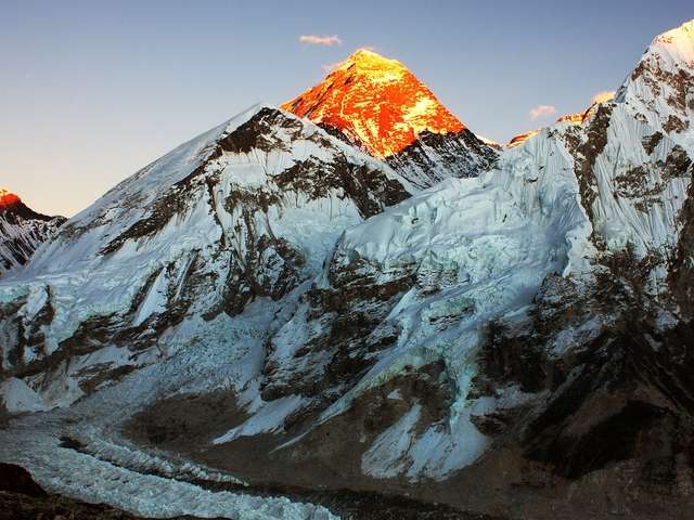
Lhotse Shar in the foreground, with Everest behind.
The north route was the first to be tried. George Mallory led the way in 1921 and returned in 1922 and 1924. In 1924 he and Andrew Irvine were last seen high on the mountain, and whether they reached the summit remains one of the great open questions in climbing. Mallory’s body was found in 1999, but Irvine and his camera have never been found. Tenzing Norgay and Edmund Hillary made the first confirmed ascent from the Nepal side in 1953. Tibet closed to foreigners after 1950 and reopened in 1980, and the North Col route has been popular ever since, alongside the South Col route from Nepal.
The Nepal alternative: high treks without a climbing permit
Trekkers who want to stand high on Everest without expedition permits can do it from Nepal. The classic trek reaches Base Camp at 5,364 m and Kala Patthar at 5,545 m, a sunrise viewpoint with Everest, Lhotse and Nuptse. Longer treks reach other high points.
| Nepal trek | High point | Days | Note |
|---|---|---|---|
| Everest Base Camp | Kala Patthar, 5,545 m | 14 | The classic trek |
| Base Camp and Gokyo Lakes | Cho La, about 5,400 m, and Gokyo Ri, 5,357 m | 17 | Lakes plus Base Camp |
| Three Passes and Base Camp | Kongma La, 5,535 m, and Kala Patthar, 5,545 m | 20 | The most complete high trek |
| Everest helicopter trek | Base Camp area, with a helicopter return | 12 | Shorter, for limited time |
Read the 14-day Everest Base Camp itinerary, the alternate routes guide, and the altitude sickness guide. For the peak itself, see Nepal’s 8,000 m peaks.
FAQ
What is Everest Advance Base Camp? The high camp on the Tibet side at about 6,500 m, used by climbers on the North Col route.
How high is Advance Base Camp? About 6,500 m (21,300 ft), about 1,300 m above the mountaineering base camp.
Is it the same as Everest Base Camp in Nepal? No. Nepal’s Base Camp is on the south side at 5,364 m. Advance Base Camp is on the north side.
Can tourists go to Advance Base Camp? Not under current reported rules. Ordinary tourists can go as far as Rongpo Monastery, at about 5,000 m.
How far is it from base camp to Advance Base Camp? About 22 km, usually walked in two days with an intermediate camp.
How do you reach the Tibet side? By road from Lhasa, normally over three days, across passes of about 5,000 m.
Do I need a permit for Tibet? Yes. Foreign travellers need a visa, a Tibet Entry Permit and an Alien Travel Permit, arranged through a licensed Chinese operator.
Can I travel to Tibet independently? No. Foreign tourists must travel with a registered tour operator.
Is the Tibet side colder than Nepal? It is generally colder and windier, so trekkers pack accordingly.
Who first tried the north route? George Mallory, in 1921, 1922 and 1924.
What is the Nepal alternative? The Everest Base Camp trek, with Kala Patthar at 5,545 m, or the Three Passes trek for a higher and longer route.
Where does the Everest trek in Nepal begin? At Lukla, with flights currently leaving from Ramechhap. See Lukla vs Ramechhap.
Trek Everest from Nepal
For dates and a quote, see the 14-day Everest Base Camp trek or the Three Passes trek, or message the team on WhatsApp or phone at +91 932 595 1234 (9 am to 7 pm IST), write to info@basecamphikes.com, or use the enquiry form.
Sources
- Xinhua: Letter from Lhasa, an odyssey to Mount Qomolangma base camp
- China Daily: Qomolangma visitors restricted, but it won’t affect mountain views
- China Daily: Papers required for foreigners for Tibet travel
- Nepal Tourism Board: Everest
Image credits: Ccdoh1, Ernie R, Goran Hoglund, Steynard, Priyanka Bhaskar, Steynard (Flickr).