By
The Annapurna region offers far more than the classic circuit. Trekkers can choose a three-day viewpoint walk, a ten-day sanctuary trek, a pilgrimage to Muktinath, or the full circuit with high side trips. This guide compares each option by days, high point, difficulty and who it suits, so you can match a route to the time you have.
The short answer
- Three to four days: Poon Hill, with sunrise views from 3,200 m.
- About ten days: Annapurna Base Camp, with close views of the peaks.
- Two weeks or more: the Annapurna Circuit, crossing Thorong La at 5,416 m.
- Add-ons: Tilicho Lake, Nar Phu with Kang La, Ghyaru and Ngawal, and two day outings on the Kali Gandaki side.
- Least time and no big climbing: Muktinath, by road or a short walk from Jomsom.
Last checked: 26 October 2026. Roads, fees and trail conditions in this region change, so confirm them for your dates.

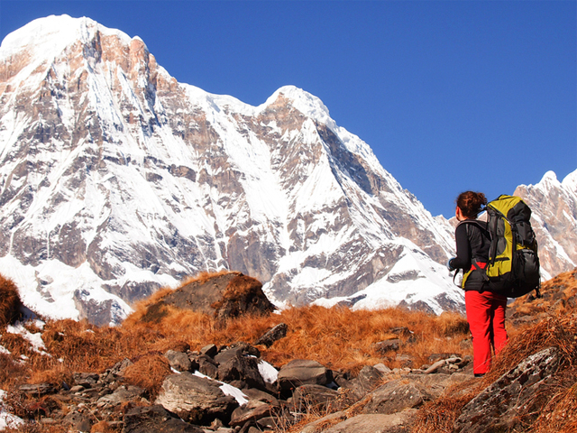
The Annapurna range, the backdrop for every route in this guide.
In this guide: Compare the options | Circuit | Base Camp | Poon Hill | Side trips | How to choose | Permits | FAQ
Annapurna trekking options compared
| Option | Typical time | High point | Difficulty | Suits |
|---|---|---|---|---|
| Poon Hill | 3 to 4 days | Poon Hill, 3,200 m | Easy to moderate | First-timers and short holidays |
| Annapurna Base Camp | About 10 days | Annapurna Base Camp, about 4,130 m | Moderate to strenuous | Close mountain views without a high pass |
| Annapurna Circuit | 15 to 18 days on foot, 10 to 14 with jeep sections | Thorong La, 5,416 m | Strenuous | Varied scenery and a big pass |
| Muktinath visit | Short trip from Jomsom or Pokhara | Muktinath, 3,749 m | Easy by road | Pilgrims and travellers with little time |
| Tilicho Lake | Adds 3 to 5 days to the circuit | Tilicho Lake, 4,919 m | Strenuous | Fit trekkers wanting a high lake |
| Nar Phu and Kang La | Adds about a week to the circuit | Kang La, about 5,300 m | Hard and remote | Experienced trekkers wanting quiet trails |
| Ghyaru and Ngawal | Adds about a day | Upper Manang villages | Moderate | Quiet villages and views before Manang |
The Annapurna Circuit

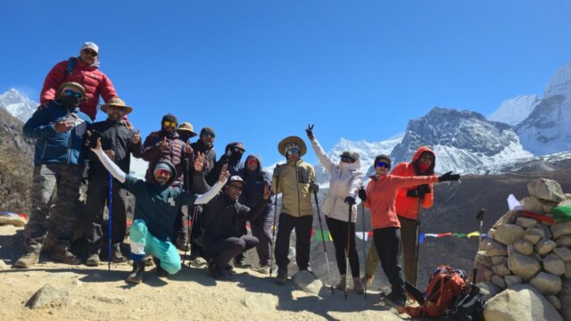
Trekkers on the way into the Annapurna mountains.
The circuit loops around the Annapurna massif. Most trekkers walk it counter-clockwise, from Besisahar up the Marsyangdi valley to Manang, over Thorong La to Muktinath, and down the Kali Gandaki gorge. The Nepal Tourism Board (NTB) calls it the most popular trek in the region, and the high point, Thorong La at 5,416 m, is the highest on the route.
The classic walk takes about 15 to 18 days. Roads now reach much of the route, so trekkers who use jeeps on some sections can finish in 10 to 14 days. The route runs from subtropical farmland to the dry high valleys of Manang and Mustang, so cultures and landscapes change almost daily. Read the full 18-day itinerary and the road and jeep sections guide.
Annapurna Base Camp

Prayer flags at Annapurna Base Camp, in the heart of the sanctuary.
This trek goes straight into the Annapurna Sanctuary, a ring of high peaks, to Annapurna Base Camp. The route follows the steep-walled valley of the Modi River and is often combined with Poon Hill, so the whole trip takes about ten days. Annapurna I, at 8,091 m, is the tenth highest mountain in the world, according to NTB. Machhapuchhre, or Fish Tail, is the sharp peak that dominates the view from the sanctuary.
It has no high pass, but the final days gain height steadily, so altitude still needs respect. Read the 10-day trek, the 14-day trek and the day-by-day guide. To compare it with Everest, read Everest Base Camp vs Annapurna Base Camp.
Poon Hill

Sunrise on the Annapurna range from Poon Hill.
Poon Hill is the best short trek in the region. It starts at Nayapul, about an hour’s drive from Pokhara, and climbs to Ghorepani, where most trekkers sleep. A pre-dawn climb to Poon Hill at 3,200 m gives sunrise over Dhaulagiri I, at 8,167 m according to NTB, and over the Annapurna range. Three days is possible, and four is more comfortable. Read the Poon Hill guide.
Side trips and add-ons
Tilicho Lake

Tilicho Lake, one of the highest lakes in the world.
NTB gives Tilicho Lake as 4,919 m, and describes it as the world’s highest lake. The side trip leaves the circuit near Manang and adds 3 to 5 days. The trail is narrow and steep, and the lake sits below glaciers and is often frozen. It is a strenuous add-on, so take it only with a guide, and not in bad weather. Crossing from the lake to Jomsom over Mesokanto La is serious and needs a guide with local knowledge. Read the Tilicho Lake guide.
Nar Phu and Kang La

Kang La pass, the high crossing from Nar to Ngawal.
The Nar Phu valley is a remote side route with old villages and steep canyons. It begins near Koto before Chame and ends over Kang La, at roughly 5,300 m, down to Ngawal. NTB’s TIMS page lists Nar Phu among routes that need a licensed guide and an agency-issued TIMS card, and it is a restricted area, so the permit and guide are arranged in advance. The pass day is long, 9 to 11 hours, and starts around 3.30 to 5 am. It is harder than Thorong La and has no lodges at the top. Read the Nar Phu permit and fee guide and the Kang La crossing guide.
Ghyaru and Ngawal

Traditional village life on the upper Manang route.
Between Pisang and Manang, the trail splits. The upper route climbs through Ghyaru and Ngawal on the north side of the valley, with wider views and fewer trekkers than the main path. Lodges in Ngawal are simpler than on the main circuit. It is an easy way to add quiet villages and a day to your acclimatisation, and it is also the base for a day trip toward Kang La.
Muktinath Temple

Muktinath, sacred to Hindus and Buddhists.
Muktinath, at 3,749 m according to NTB, is holy to both Buddhists and Hindus. It lies at the foot of Thorong La, and visitors can reach it without the pass. Jomsom has an airport, and a motorable road runs from Muktinath to Beni, with buses from Beni to Pokhara. The landscape around it is dry and high, and many travellers come for the temple and the Kali Gandaki valley alone. Read the Muktinath guide.
Dhaulagiri Icefall day outing

Dhaulagiri and its icefall, seen from the Kali Gandaki side.
A tough day outing from Larjung, in the Kali Gandaki valley, climbs steeply toward the Dhaulagiri icefall with views of Dhaulagiri and the Nilgiri peaks. The trail is faint and does not reach the icefall itself, so go with your guide, and carry food and water for a full day.
Annapurna North Base Camp

Annapurna South seen from the trail near Jhinu Danda.
The north side of Annapurna is the hardest and least visited option here. The trail is steep, poorly marked in places and may need fixed ropes. It is a route for experienced teams with a guide who knows it, and not for a standard trekking holiday.
How to choose
| If you have | Choose | Why |
|---|---|---|
| 3 to 4 days | Poon Hill | Big views for little time, near Pokhara |
| 7 to 10 days | Annapurna Base Camp | Close views, no high pass |
| 10 to 14 days | Annapurna Circuit with jeep sections | Most of the route, shorter on foot |
| 15 to 18 days | Full Annapurna Circuit | The classic walk with Thorong La |
| 3 weeks or more | Circuit with Tilicho Lake or Nar Phu | Adds a high lake or a remote pass |
| Very little time and no wish to trek | Muktinath by road | Culture and landscape without the climb |
Permits across the region
NTB says trekkers on the Annapurna Circuit, Nar Phu, Tilicho (Mesokanto), Poon Hill and Annapurna Base Camp routes must be accompanied by a licensed guide and carry an agency-issued TIMS card, under rules effective 31 March 2023. NTB lists the TIMS fee at NPR 2,000 for foreigners and NPR 1,000 for SAARC nationals. Annapurna Conservation Area entry is listed at NPR 3,000 for foreigners and NPR 1,000 for SAARC nationals on one NTB page, and at NPR 2,000 and NPR 200 on another, so confirm the fee when the permit is issued. Children under 10 enter free. The team arranges all permits. See the Annapurna permits guide.
Best season
NTB lists March to May and September to November as the best seasons for the Annapurna region. Winter is extreme, with heavy snow at high altitude, and the monsoon brings rain and landslides on lower trails. Muktinath and Mustang lie in the rain shadow, so a Muktinath visit is possible in the monsoon months.
FAQ
What are the main trekking options in the Annapurna region? The main options are Poon Hill, Annapurna Base Camp and the Annapurna Circuit, with side trips such as Tilicho Lake, Nar Phu and Kang La, and a visit to Muktinath.
What is the shortest Annapurna trek? Poon Hill, which takes 3 to 4 days from Nayapul and gives sunrise views from 3,200 m.
How many days is Annapurna Base Camp? About 10 days, usually combined with Poon Hill.
How many days is the Annapurna Circuit? About 15 to 18 days on foot. With jeep sections, it takes 10 to 14 days.
How high is Thorong La? 5,416 m, the highest point of the circuit.
How high is Tilicho Lake? NTB gives 4,919 m. The side trip adds 3 to 5 days.
Is Kang La harder than Thorong La? Yes. It is remote and has no lodges at the top, and the pass day runs 9 to 11 hours.
Do I need a guide? NTB states that a licensed guide and an agency-issued TIMS card are required on the circuit, Nar Phu, Tilicho, Poon Hill and Annapurna Base Camp routes.
When is the best time to go? March to May and September to November, according to NTB.
Can I visit Muktinath without trekking? Yes. Jomsom has an airport, and a motorable road runs from Muktinath to Beni, with buses on to Pokhara.
Which is better, the circuit or Annapurna Base Camp? The circuit gives variety and a high pass. The base camp trek is shorter and goes right into the mountains, with no pass.
How does Annapurna compare with Manaslu? See Manaslu Circuit vs Annapurna Circuit.
Plan your Annapurna trek
For dates and a quote, see the 18-day Annapurna Circuit, the 10-day Annapurna Base Camp trek, or message the team on WhatsApp or phone at +91 932 595 1234 (9 am to 7 pm IST), write to info@basecamphikes.com, or use the enquiry form.
Sources
- Nepal Tourism Board: Annapurna region
- Nepal Tourism Board: TIMS card
- Nepal Tourism Board: park entry fees
- Nepal Tourism Board: Annapurna Conservation Area
Image credits: Davy Demaline, Dey, Benoit, LevyGlick (Flickr).