
 By
Nepal holds eight of the world’s fourteen highest mountains, 27 officially listed trekking peaks and hundreds of other climbable summits. Ask for a “list of peaks in Nepal” and you get a mix of all three, with heights that disagree from page to page. This guide sets out one clean list: the eight peaks above 8,000 m, a selection of high expedition peaks, and the complete list of 27 trekking peaks managed by the Nepal Mountaineering Association (NMA), with heights, ranges and districts. It also explains how Nepal sorts peaks, so you know which ones you can climb with a guide and which need a full expedition.
The short answer
- Eight peaks above 8,000 m lie in or on the border of Nepal, from Everest (8,848 m) to Annapurna I (8,091 m), according to the Nepal Tourism Board (NTB).
- 27 trekking peaks are on the NMA list, ranging from 5,849 m (Khongma Tse) to 6,584 m (Chulu East). Mera Peak, Island Peak and Lobuche East are the best known.
- 326 peaks in all are open to expeditions, and 103 of them have never been climbed, says NTB.
- Peaks above 6,500 m fall under the Ministry of Tourism, while NMA handles trekking peaks. Peaks below 5,800 m need no climbing permit.
Last checked: 22 October 2026. Heights come from NTB and NMA pages. Other sources round some of them differently, so use the figures here as the official ones.
Find your peak by goal
Start here if you want an answer rather than a list.
| If you want to… | Look at |
|---|---|
| See the highest mountains from a trail | The eight 8,000 m peaks, seen on the Everest, Annapurna and Manaslu treks |
| Climb your first Himalayan summit | Mera Peak (6,470 m) or Island Peak (6,160 m) |
| Try a steeper, shorter summit day | Lobuche East (6,090 m) |
| Climb the highest trekking peak | Chulu East (6,584 m), in the Annapurna and Manang area |
| Find a peak outside the Everest region | The Annapurna, Langtang, Rolwaling, Manaslu and Ganesh Himal groups in the region table |
| Know which permit applies | The classification and permits sections below |

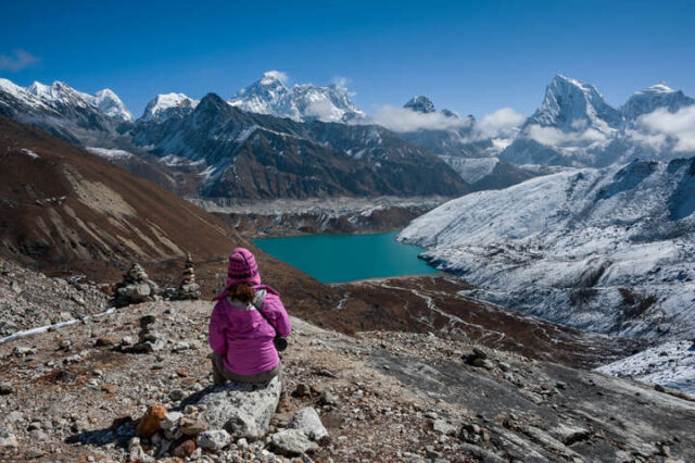
Everest and the Gokyo valley from Renjo La, one of the many views of the highest peaks that treks in the Khumbu region offer.
In this guide: Find your peak | Highest mountains | How Nepal classifies peaks | Height ladder | The eight 8,000 m peaks | Other high expedition peaks | The 27 trekking peaks | Peaks by region | Which peaks you see on treks | Permits | Which peak to climb | FAQ
Highest mountains in Nepal, ranked
Answer: Everest (8,848 m) is the highest mountain in Nepal, followed by Kanchenjunga (8,586 m), Lhotse (8,516 m), Makalu (8,463 m), Cho Oyu (8,201 m), Dhaulagiri I (8,167 m), Manaslu (8,163 m) and Annapurna I (8,091 m).
| Rank in Nepal | Mountain | Height (NTB) | World rank (NTB) |
|---|---|---|---|
| 1 | Everest | 8,848 m | Highest in the world |
| 2 | Kanchenjunga | 8,586 m | Third highest in the world |
| 3 | Lhotse | 8,516 m | Fourth highest in the world |
| 4 | Makalu | 8,463 m | Fifth highest in the world |
| 5 | Cho Oyu | 8,201 m | Sixth highest in the world |
| 6 | Dhaulagiri I | 8,167 m | Seventh highest in the world |
| 7 | Manaslu | 8,163 m | Eighth highest in the world |
| 8 | Annapurna I | 8,091 m | Tenth highest in the world |
Everest and Kanchenjunga are on the borders with Tibet and Sikkim, and Cho Oyu is on the border with China, so the ranking counts mountains Nepal shares. Below 8,000 m, the next highest peaks in the government publication used here are Nuptse (7,855 m) and Putha Hiunchuli (7,246 m).
How Nepal classifies its peaks
Answer: Nepal sorts peaks into four classes by height and permit authority: 8,000 m peaks, expedition peaks above 6,500 m, 27 NMA trekking peaks from 5,800 to 6,584 m, and lower peaks that need no climbing permit.
| Class | Height | Managed by | How many | What it means |
|---|---|---|---|---|
| 8,000 m peaks | Above 8,000 m | Ministry of Tourism | 8 (NTB) | Full expeditions with a Liaison Officer |
| Expedition peaks | Above 6,500 m | Ministry of Tourism | 326 open peaks, 103 never climbed (NTB) | A Liaison Officer is required, plus a refundable garbage deposit |
| Trekking peaks (NMA peaks) | 5,800 m to 6,584 m | Nepal Mountaineering Association | 27 (NMA) | Climbable with a licensed guide. NTB calls the title misleading, because real climbing skills and gear are needed. |
| Lower peaks | Below 5,800 m | No climbing permit | Not counted | Regional permits may still apply |
The bands overlap slightly: NTB’s 6,500 m and 5,800 to 6,584 m lines cross between 6,500 m and 6,584 m. Two of the 27 NMA peaks, Chulu East and Singu Chuli, stand above 6,500 m for that reason. For what “technical” and “non-technical” mean on the mountain, read the technical vs non-technical peaks guide.
The height ladder
| Peak | Height | Profile |
|---|---|---|
| Everest | 8,848 m |
|
| Annapurna I (lowest of the eight) | 8,091 m |
|
| Highest trekking peak: Chulu East | 6,584 m |
|
| Mera Peak | 6,470 m |
|
| Island Peak | 6,160 m |
|
| Lobuche East | 6,090 m |
|
| Lowest trekking peak: Khongma Tse | 5,849 m |
|
| Line: expedition peaks start | 6,500 m |
|
| Line: climbing permit needed | 5,800 m |
|
Purple bars are 8,000 m peaks, green bars are NMA trekking peaks and amber bars mark the two official lines. Even the highest trekking peak is about 2,260 m below Everest.
The eight 8,000 m peaks of Nepal
Answer: Nepal has eight peaks above 8,000 m: Everest, Kanchenjunga, Lhotse, Makalu, Cho Oyu, Dhaulagiri I, Manaslu and Annapurna I. Heights and first ascents below are from NTB.
| World rank (NTB) | Peak | Height (NTB) | Height profile | Where | First ascent | First Nepali to summit |
|---|---|---|---|---|---|---|
| 1st | Everest (Sagarmatha) | 8,848 m |
|
Khumbu, inside Sagarmatha National Park | 1953, by Tenzing Norgay and Edmund Hillary | Not stated on the NTB Everest page |
| 3rd | Kanchenjunga | 8,586 m |
|
Nepal-Sikkim (India) border, about 128 km east of Everest | 25 May 1955, British expedition led by Charles Evans (George Band and Joe Brown) | Ang Phurba Sherpa, 14 May 1980 |
| 4th | Lhotse | 8,516 m |
|
Khumbu, joined to Everest by the South Col | 18 May 1956, Swiss team (Ernst Reiss and Fritz Luchsinger) | Urkien Tshering Sherpa, 8 May 1977 |
| 5th | Makalu | 8,463 m |
|
Khumbu region, about 20 km east of Everest, in Makalu Barun National Park | 15 May 1955, French expedition led by Jean Franco (Lionel Terray and Jean Couzy) | Ang Chepal Sherpa, 1 May 1978 |
| 6th | Cho Oyu | 8,201 m |
|
China-Nepal border, about 20 km west of Everest | 19 October 1954, Austrian expedition led by Herbert Tichy (with Joseph Jochler and Pasang Dawa Lama) | Ang Phuri Sherpa, 29 April 1987 |
| 7th | Dhaulagiri I | 8,167 m |
|
Northwest of Pokhara | 13 May 1960, Swiss expedition led by Max Eiselin | Nawang Dorjee Sherpa, 1960, on the first-ascent team |
| 8th | Manaslu | 8,163 m |
|
Gorkha-Manang border, about 64 km east of Annapurna | 9 May 1956, third Japanese expedition led by Yuko Maki (Imanishi and Gyaltsen) | Urkien Tshering Sherpa, 22 April 1973 |
| 10th | Annapurna I | 8,091 m |
|
Annapurna region | 3 June 1950, French expedition (Maurice Herzog and Louis Lachenal) | Sonam Wolang Sherpa, 13 October 1977 |
- Shared borders: Kanchenjunga sits on the border with the Indian state of Sikkim, and Cho Oyu on the border between China and Nepal. The other six are described by NTB as lying within Nepal’s mountain regions.
- Dhaulagiri is, per NTB, the highest mountain within the borders of a single country, and after Captain William Webb, the first European to see it, calibrated its height in 1809, it was thought for years to be the highest in the world.
- Kanchenjunga’s other summits: NTB lists Yalungkang (8,505 m), Kanchenjunga West (8,420 m) and the Twin Peaks (8,476 m) as part of the massif. Lhotse also has Lhotse Middle (8,414 m) and Lhotse Shar (8,383 m).
- Firsts: the 1950 ascent of Annapurna I was the first of any 8,000 m peak. Manaslu was the first 8,000 m peak climbed by an Asian expedition, according to NTB.
Heights differ by source. NTB’s own pages give 8,463 m for Makalu, 8,201 m for Cho Oyu and 8,167 m for Dhaulagiri, and other publications use slightly different values. This list uses NTB’s figures throughout.
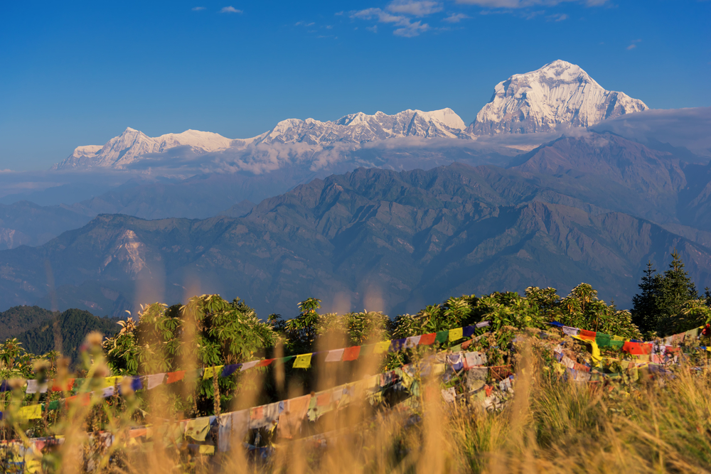
Dhaulagiri from Poon Hill, one of the eight 8,000 m peaks and visible on the Annapurna trek.
The order of first ascents
| Year | Peak | Date | Who |
|---|---|---|---|
| 1950 | Annapurna I | 3 June | French expedition: Herzog and Lachenal |
| 1953 | Everest | 1953 | Tenzing Norgay and Edmund Hillary (NTB gives no day on its Everest page) |
| 1954 | Cho Oyu | 19 October | Austrian expedition: Tichy, Jochler and Pasang Dawa Lama |
| 1955 | Makalu | 15 May | French expedition: Terray and Couzy |
| 1955 | Kanchenjunga | 25 May | British expedition: Band and Brown |
| 1956 | Lhotse | 18 May | Swiss team: Reiss and Luchsinger |
| 1956 | Manaslu | 9 May | Japanese expedition: Imanishi and Gyaltsen |
| 1960 | Dhaulagiri I | 13 May | Swiss expedition led by Max Eiselin |
All eight were first climbed within ten years, between 1950 and 1960. The first Nepali summits followed from 1960 (Dhaulagiri) to 1987 (Cho Oyu), according to NTB.

Manaslu, the eighth highest mountain in the world according to NTB.

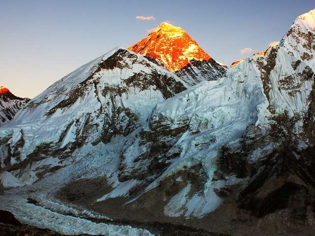
Everest from Kala Patthar (5,545 m), the standard trekker viewpoint for the highest of the eight 8,000 m peaks.
Other high expedition peaks
Answer: 326 peaks are open to expeditions and 103 have never been climbed, according to NTB. Nuptse (7,855 m) is the highest after the eight in the government list used here.
NTB says 326 peaks are open for mountaineering, and 103 of them have never been climbed. The government publication Mountaineering in Nepal: Facts and Figures (2013, data to December 2012) lists many of them with heights, and the table below uses those printed heights. They are older figures, so treat them as a guide and confirm the current height and rules before planning.
| Peak | Height as printed | Height profile |
|---|---|---|
| Nuptse | 7,855 m |
|
| Putha Hiunchuli | 7,246 m |
|
| Himjung | 7,140 m |
|
| Barun Tse | 7,129 m |
|
| Himlung Himal | 7,126 m |
|
| Janak | 7,090 m |
|
| Gyajikang | 7,038 m |
|
| Ama Dablam | 6,812 m |
|
| Kyashar | 6,770 m |
|
| Jobo Rinjang | 6,666 m |
|
All of these are above 6,500 m, so they sit under the Ministry of Tourism, need a Liaison Officer and pay a refundable garbage deposit. Anyone aiming for them should build up through the trekking peaks below first. The peaks guide explains how.
The 27 official trekking peaks (NMA list)
Answer: NMA lists 27 trekking peaks, from Khongma Tse (5,849 m) to Chulu East (6,584 m). Every peak is below, from the highest down.
| # | Peak | Height (NMA) | Height profile | Range | District |
|---|---|---|---|---|---|
| 1 | Chulu East | 6,584 m |
|
Damodar | Manang |
| 2 | Singu Chuli (Fluted Peak) | 6,501 m |
|
Annapurna Himal | Kaski |
| 3 | Mera Peak | 6,470 m |
|
Khumbu Himal | Solukhumbu |
| 4 | Mt. Chola Tse | 6,440 m |
|
Khumbu | Solukhumbu |
| 5 | Mt. Langsisa Ri | 6,427 m |
|
Jugal | Rasuwa |
| 6 | Chulu West | 6,419 m |
|
Damodar | Manang |
| 7 | Hiun Chuli | 6,411 m |
|
Annapurna | Kaski |
| 8 | Kusum Kanguru | 6,367 m |
|
Khumbu Himal | Solukhumbu |
| 9 | Mt. Ombigaichen | 6,340 m |
|
Mahalangur | Solukhumbu |
| 10 | Pharchamo | 6,279 m |
|
Rolwaling Himal | Dolakha / Solukhumbu |
| 11 | Mt. Chekigo | 6,257 m |
|
Gaurishankar | Dolakha |
| 12 | Mt. Kyazo Ri | 6,186 m |
|
Mahalangur | Solukhumbu |
| 13 | Imja Tse (Island Peak) | 6,160 m |
|
Khumbu Himal | Solukhumbu |
| 14 | Mt. Nirekha | 6,159 m |
|
Mahalangur | Solukhumbu |
| 15 | Mt. Lobuche West | 6,145 m |
|
Khumbu | Solukhumbu |
| 16 | Mt. Bokta | 6,143 m |
|
Kanchenjunga | Taplejung |
| 17 | Pisang Peak | 6,091 m |
|
Damodar | Manang |
| 18 | Lobuche East | 6,090 m |
|
Khumbu Himal | Solukhumbu |
| 19 | Mt. Abi | 6,043 m |
|
Mahalangur | Solukhumbu |
| 20 | Mt. Yubra Himal | 6,035 m |
|
Langtang Himal | Rasuwa |
| 21 | Mt. Phari Lapcha | 6,017 m |
|
Mahalangur | Solukhumbu |
| 22 | Kwangde | 6,011 m |
|
Rolwaling Himal | Solukhumbu |
| 23 | Mt. Larkya Peak | 6,010 m |
|
Manaslu | Manang / Gorkha |
| 24 | Ramdong Go | 5,900 m |
|
Rolwaling Himal | Ramechhap / Dolakha |
| 25 | Paldor Peak | 5,896 m |
|
Ganesh Himal | Dhading / Rasuwa |
| 26 | Ghanja-la Chuli (Naya Kanga) | 5,863 m |
|
Langtang Himal | Rasuwa / Sindhupalchok |
| 27 | Khongma Tse (Mehra) | 5,849 m |
|
Khumbu Himal | Solukhumbu |
The heights are NMA’s official figures. Package pages and operators sometimes give slightly different numbers, for example 6,189 m for Island Peak against NMA’s 6,160 m and 6,476 m for Mera Peak against 6,470 m. NMA’s list names the peaks by their local spellings, so Lobuche East appears as “Lobuje East”.
Quick facts from the list
- Highest: Chulu East at 6,584 m. Lowest: Khongma Tse (Mehra) at 5,849 m.
- Above 6,500 m: Chulu East and Singu Chuli (Fluted Peak), both on the borderline between trekking and expedition peaks.
- Solukhumbu district holds 14 of the 27, more than any other district, which is why the Everest region dominates the list.
- Best known: Mera Peak (6,470 m), Island Peak (6,160 m) and Lobuche East (6,090 m). Read the guides to Mera Peak, Island Peak and Lobuche East.
The 27 peaks by height band
| Height band | Count | Peaks |
|---|---|---|
| 5,800 to 5,999 m | 4 | Ramdong Go, Paldor Peak, Ghanja-la Chuli (Naya Kanga), Khongma Tse (Mehra) |
| 6,000 to 6,199 m | 12 | Mt. Kyazo Ri, Imja Tse (Island Peak), Mt. Nirekha, Mt. Lobuche West, Mt. Bokta, Pisang Peak, Lobuche East, Mt. Abi, Mt. Yubra Himal, Mt. Phari Lapcha, Kwangde, Mt. Larkya Peak |
| 6,200 to 6,399 m | 4 | Kusum Kanguru, Mt. Ombigaichen, Pharchamo, Mt. Chekigo |
| 6,400 to 6,584 m | 7 | Chulu East, Singu Chuli (Fluted Peak), Mera Peak, Mt. Chola Tse, Mt. Langsisa Ri, Chulu West, Hiun Chuli |
Same peak, different names
NMA’s list uses local names, and operators use others. This table matches them up.
| Name you may see | NMA list name | Height (NMA) |
|---|---|---|
| Island Peak | Imja Tse | 6,160 m |
| Lobuche East | Lobuje East | 6,090 m |
| Lobuche West | Mt. Lobuje West | 6,145 m |
| Mehra Peak | Khongma Tse (Mehra) | 5,849 m |
| Naya Kanga | Ghanja-la Chuli (Naya Kanga) | 5,863 m |
| Fluted Peak | Singu Chuli (Fluted Peak) | 6,501 m |
| Everest | Sagarmatha (NTB’s Nepali name) | 8,848 m |

Imja Tse (Island Peak, 6,160 m), one of the 27 NMA trekking peaks and the best-known fixed-rope climb among them.
The 27 trekking peaks by region
Answer: 12 of the 27 peaks are in the Khumbu and Mahalangur ranges of the Everest region, 5 are in Annapurna and Manang, 4 in Rolwaling and Gaurishankar, and 3 in Langtang and Jugal.
| Region | Number of NMA peaks |
|---|---|
| Khumbu and Mahalangur (Everest region) | 12 |
| Annapurna and Manang | 5 |
| Rolwaling and Gaurishankar | 4 |
| Langtang and Jugal | 3 |
| Kanchenjunga | 1 |
| Manaslu | 1 |
| Ganesh Himal | 1 |
- Everest region: the largest group, including Mera Peak, Island Peak, Lobuche East and West, Kusum Kanguru and the peaks reached via Gokyo (Abi, Nirekha, Ombigaichen and Kyazo Ri).
- Annapurna and Manang: Chulu East, Chulu West, Pisang Peak, Hiun Chuli and Singu Chuli, with Chulu and Pisang reached via Besisahar and Hiun Chuli and Singu Chuli via Pokhara, according to NMA’s caravan routes.
- Langtang and Ganesh Himal: Ghanja-la Chuli (Naya Kanga), Yubra Himal, Langsisa Ri and Paldor Peak, in Rasuwa, Sindhupalchok and Dhading districts.
- Rolwaling and Gaurishankar: Pharchamo, Ramdong Go, Kwangde and Chekigo, reached from Dolakha and Solukhumbu.
- Manaslu and Kanchenjunga: Larkya Peak on the Manaslu circuit, and Bokta in the far east.
Which peaks you see on the popular treks
Answer: The Everest, Annapurna and Manaslu treks show you the 8,000 m peaks from the trail, with no climbing needed.
| Trek | Peaks in view (NTB) |
|---|---|
| Everest Base Camp | Everest from Kala Patthar (5,545 m). Everest, Lhotse and Ama Dablam from Tengboche. Cho Oyu is also in Sagarmatha National Park. |
| Annapurna Base Camp | Annapurna I (8,091 m), the Fishtail (Machhapuchhre) on the approach, and Dhaulagiri from Poon Hill |
| Other Everest-region routes | Everest, Lhotse and Cho Oyu, with Lumding offering a view of more than 45 peaks |
| Manaslu Circuit | Manaslu (8,163 m), with Larkya Peak on the NMA list nearby |
The treks are the best way to see the 8,000 m peaks up close without an expedition. See the complete Everest Base Camp guide and the Everest Base Camp vs Annapurna Base Camp comparison.

The Annapurna Himal, home of Annapurna I at 8,091 m.
Permits and fees by peak class
Answer: Trekking peaks need an NMA permit (US$350 in spring, US$175 in other seasons for the standard group). Peaks above 6,500 m need a Ministry of Tourism permit and a Liaison Officer. Peaks below 5,800 m need no climbing permit.
| Class | What the official pages say | Source |
|---|---|---|
| Peaks below 5,800 m | No climbing permit. Regional permits may apply. | NTB |
| Trekking peaks (NMA) | NMA permit. Royalty for the standard group: US$350 in spring (March to May), US$175 in other seasons. Chulu East and Singu Chuli: US$500 spring, US$250 autumn, US$200 winter and summer. | NMA service charges page |
| Expedition peaks above 6,500 m | Ministry of Tourism permit, a Liaison Officer and a refundable garbage deposit | NTB |
| Everest | NTB’s August 2025 trade notice mentions US$15,000 for Everest. No other royalty table was found, so confirm the current amount with the Department of Tourism. | NTB trade notice |
NMA’s service charges page gives no effective date, and its rules page dates from 1981. The NMA rules set a one-month permit period counted from time above base camp, a maximum group of 12 and a guide registered with NMA. A reputable operator includes the climbing permit in the package.
Which peak should you climb?
Answer: Trek above 4,000 m, then climb Mera Peak or Island Peak, then Lobuche East, and consider an expedition peak only after that.
- Trek above 4,000 m first. Everest Base Camp or Annapurna Base Camp shows how you handle altitude.
- Climb a first trekking peak. Mera Peak tests altitude without rope work. Island Peak adds fixed ropes.
- Move to a steeper trekking peak, such as Lobuche East, once you are comfortable with ropes and long summit days.
- Consider an expedition peak only after that, with an expedition specialist.
The step-by-step comparison is in the technical vs non-technical peaks guide.
Climb a peak in Nepal with Base Camp Hikes
Base Camp Hikes runs guided climbs of Mera Peak, Island Peak and Lobuche East, with licensed guides, climbing gear and permits arranged. See the itineraries and current prices for Mera Peak, Island Peak and Lobuche East. Send your dates, fitness and experience and the team will recommend a peak: call or WhatsApp +91 932 595 1234 (9 am to 7 pm IST), email info@basecamphikes.com or use the enquiry form.
FAQ
What is Imja Tse? Imja Tse is the official name of Island Peak, at 6,160 m on the NMA list. It is one of 14 NMA peaks in Solukhumbu district.
How many trekking peaks are in the Everest region? NMA’s list has 14 peaks in Solukhumbu district, including Mera Peak, Island Peak and Lobuche East and West. The rest are spread across the Annapurna, Langtang, Rolwaling, Manaslu, Ganesh and Kanchenjunga areas.
In what order were the 8,000 m peaks first climbed? Annapurna I (1950), Everest (1953), Cho Oyu (1954), Makalu and Kanchenjunga (1955), Lhotse and Manaslu (1956), then Dhaulagiri I (1960).
How many 8,000 m peaks are in Nepal? Eight, according to NTB: Everest, Kanchenjunga, Lhotse, Makalu, Cho Oyu, Dhaulagiri, Manaslu and Annapurna I. Kanchenjunga and Cho Oyu are shared with India and China.
What is the highest peak in Nepal? Everest (Sagarmatha), at 8,848 m. Kanchenjunga (8,586 m) is the next highest, followed by Lhotse (8,516 m).
What is the second highest mountain in Nepal? Kanchenjunga at 8,586 m, which NTB calls the third highest in the world. It lies on the border with Sikkim.
How many trekking peaks are there in Nepal? The NMA list names 27 trekking peaks, with heights from 5,849 m to 6,584 m.
What is the highest trekking peak in Nepal? Chulu East, at 6,584 m on the NMA list. Singu Chuli (6,501 m) and Mera Peak (6,470 m) follow.
What is the lowest trekking peak in Nepal? Khongma Tse (Mehra), at 5,849 m on the NMA list.
What is the easiest peak to climb in Nepal? NMA gives no ranking. Among the best known, Mera Peak needs the fewest climbing skills, but it is the highest of the three popular peaks and has a long summit day, so it is not easy.
How many peaks are open for climbing in Nepal? NTB says 326 peaks are open for expeditions, and 103 of them have never been climbed.
Which peaks need a Liaison Officer? Expeditions to peaks above 6,500 m, according to NTB.
Do peaks below 5,800 m need a permit? NTB says no climbing permit is needed, though regional permits may still apply.
Which 8,000 m peak was climbed first? Annapurna I, on 3 June 1950, was the first of any 8,000 m peak. Everest followed in 1953.
Which 8,000 m peak is the easiest? NTB calls Cho Oyu the easiest eight-thousander to climb and one of the most popular, though no 8,000 m peak is easy.
Which 8,000 m peak lies entirely within one country? NTB says Dhaulagiri is the highest mountain within the borders of a single country.
Which peaks can I see on the Everest Base Camp trek? Everest, Lhotse and Ama Dablam, plus Cho Oyu in the same park, according to NTB. Kala Patthar (5,545 m) gives the classic Everest view.
Sources
- Nepal Mountaineering Association, NMA peaks (the 27 trekking peaks, heights, ranges and districts)
- Nepal Mountaineering Association, service charges and rules and guidelines
- Nepal Tourism Board, mountaineering (classes, 8,000 m list, 326 and 103 peaks, Liaison Officer, deposit, season)
- Nepal Tourism Board peak pages: Everest, Kanchenjunga, Lhotse, Makalu, Cho Oyu, Dhaulagiri, Manaslu, Annapurna and the climb of Annapurna (heights, first ascents, first Nepali summiteers)
- Government of Nepal, Mountaineering in Nepal: Facts and Figures (2013, data to December 2012; printed heights of other expedition peaks)
- Nepal Tourism Board trade notice on peak permit fees (Everest fee mention, August 2025)
- Not found: no government royalty table for 8,000 m peaks, no Everest first-Nepali entry on the NTB Everest page, and the 2012 publication’s heights are older figures. NMA is not a government body, though NTB names it as manager of the trekking peaks.
Information correct as of 22 October 2026.